
W61A Ground Anchor Farm, New Bern, NC, USA - Earthquake Result Viewer
| ||||||||||||||||||
| ||||||||||||||||||
| ||||||||||||||||||
|
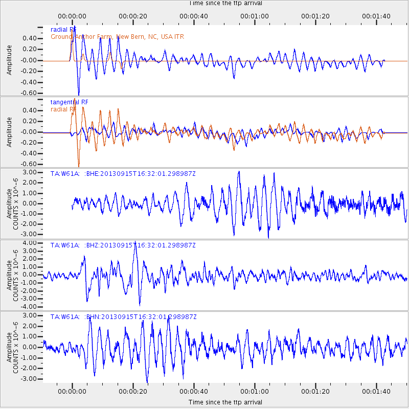
Signal To Noise
| Channel | StoN | STA | LTA |
| TA:W61A: :BHZ:20130915T16:32:01.298987Z | 4.0084615 | 1.0996162E-6 | 2.7432375E-7 |
| TA:W61A: :BHN:20130915T16:32:01.298987Z | 1.5568378 | 6.9718527E-7 | 4.4782138E-7 |
| TA:W61A: :BHE:20130915T16:32:01.298987Z | 1.4404624 | 6.322487E-7 | 4.3892067E-7 |
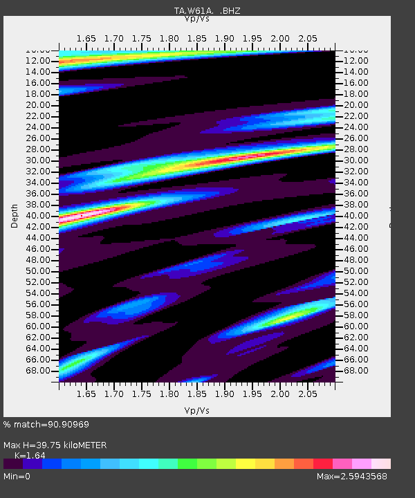
| Arrivals | |
| Ps | 4.1 SECOND |
| PpPs | 15 SECOND |
| PsPs/PpSs | 19 SECOND |

