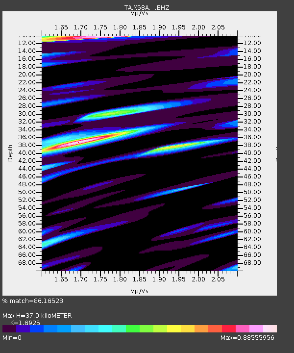
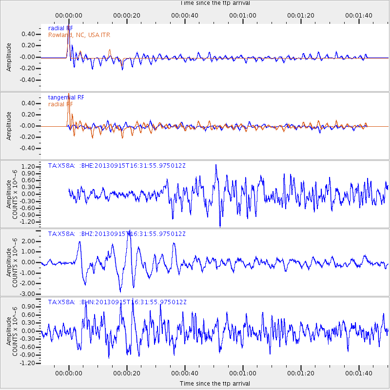
X58A Rowland, NC, USA - Earthquake Result Viewer

Earthquake location: Andreanof Islands, Aleutian Is.
Earthquake latitude/longitude: 51.6/-174.7
Earthquake time(UTC): 2013/09/15 (258) 16:21:37 GMT
Earthquake Depth: 24 km
Earthquake Magnitude: 6.1 MWW, 5.7 MI, 5.7 ML, 6.0 MWB, 6.1 MWC, 6.1 MWW
Earthquake Catalog/Contributor: NEIC PDE/NEIC COMCAT
Network: TA USArray Transportable Network (new EarthScope stations)
Station: X58A Rowland, NC, USA
Lat/Lon: 34.55 N/79.34 W
Elevation: 45 m
Distance: 66.9 deg
Az: 63.328 deg
Baz: 317.496 deg
Ray Param: 0.057302043
Estimated Moho Depth: 37.0 km
Estimated Crust Vp/Vs: 1.69
Assumed Crust Vp: 6.565 km/s
Estimated Crust Vs: 3.879 km/s
Estimated Crust Poisson's Ratio: 0.23
Radial Match: 86.16528 %
Radial Bump: 400
Transverse Match: 72.92817 %
Transverse Bump: 400
SOD ConfigId: 626651
Insert Time: 2014-04-18 17:37:58.048 +0000
GWidth: 2.5
Max Bumps: 400
Tol: 0.001

Signal To Noise

ChannelStoNSTALTA
TA:X58A: :BHZ:20130915T16:31:55.975012Z6.77523768.3791025E-71.2367245E-7
TA:X58A: :BHN:20130915T16:31:55.975012Z2.21082973.181905E-71.4392356E-7
TA:X58A: :BHE:20130915T16:31:55.975012Z1.8688122.7113356E-71.4508338E-7
Arrivals
Ps4.1 SECOND
PpPs15 SECOND
PsPs/PpSs19 SECOND