Y55A Saluda, SC, USA - Earthquake Result Viewer
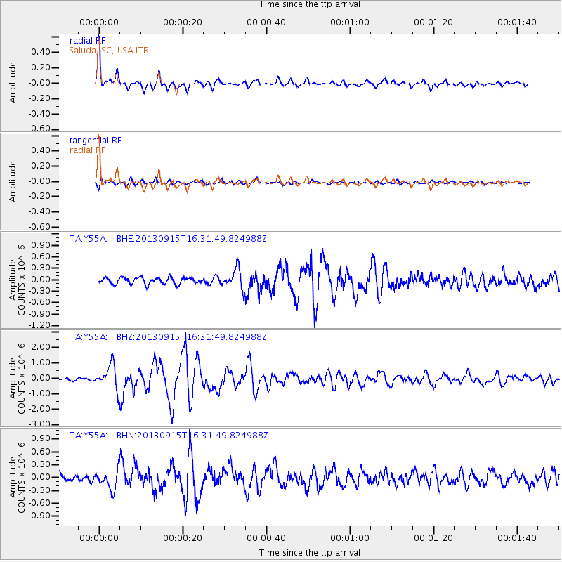
Earthquake location: Andreanof Islands, Aleutian Is.
Earthquake latitude/longitude: 51.6/-174.7
Earthquake time(UTC): 2013/09/15 (258) 16:21:37 GMT
Earthquake Depth: 24 km
Earthquake Magnitude: 6.1 MWW, 5.7 MI, 5.7 ML, 6.0 MWB, 6.1 MWC, 6.1 MWW
Earthquake Catalog/Contributor: NEIC PDE/NEIC COMCAT
Network: TA USArray Transportable Network (new EarthScope stations)
Station: Y55A Saluda, SC, USA
Lat/Lon: 33.94 N/81.86 W
Elevation: 164 m
Distance: 65.9 deg
Az: 65.456 deg
Baz: 316.937 deg
Ray Param: 0.057938565
Estimated Moho Depth: 35.75 km
Estimated Crust Vp/Vs: 1.76
Assumed Crust Vp: 6.565 km/s
Estimated Crust Vs: 3.725 km/s
Estimated Crust Poisson's Ratio: 0.26
Radial Match: 91.50079 %
Radial Bump: 372
Transverse Match: 74.12099 %
Transverse Bump: 400
SOD ConfigId: 626651
Insert Time: 2014-04-18 17:38:25.027 +0000
GWidth: 2.5
Max Bumps: 400
Tol: 0.001

Signal To Noise

ChannelStoNSTALTA
TA:Y55A: :BHZ:20130915T16:31:49.824988Z7.1184168.143497E-71.1440041E-7
TA:Y55A: :BHN:20130915T16:31:49.824988Z2.85489342.2274148E-77.8020946E-8
TA:Y55A: :BHE:20130915T16:31:49.824988Z3.13521932.574717E-78.2122384E-8
Arrivals
Ps4.3 SECOND
PpPs14 SECOND
PsPs/PpSs19 SECOND