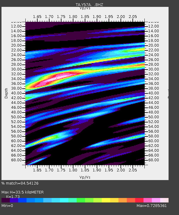
Y57A Sumter, SC, USA - Earthquake Result Viewer
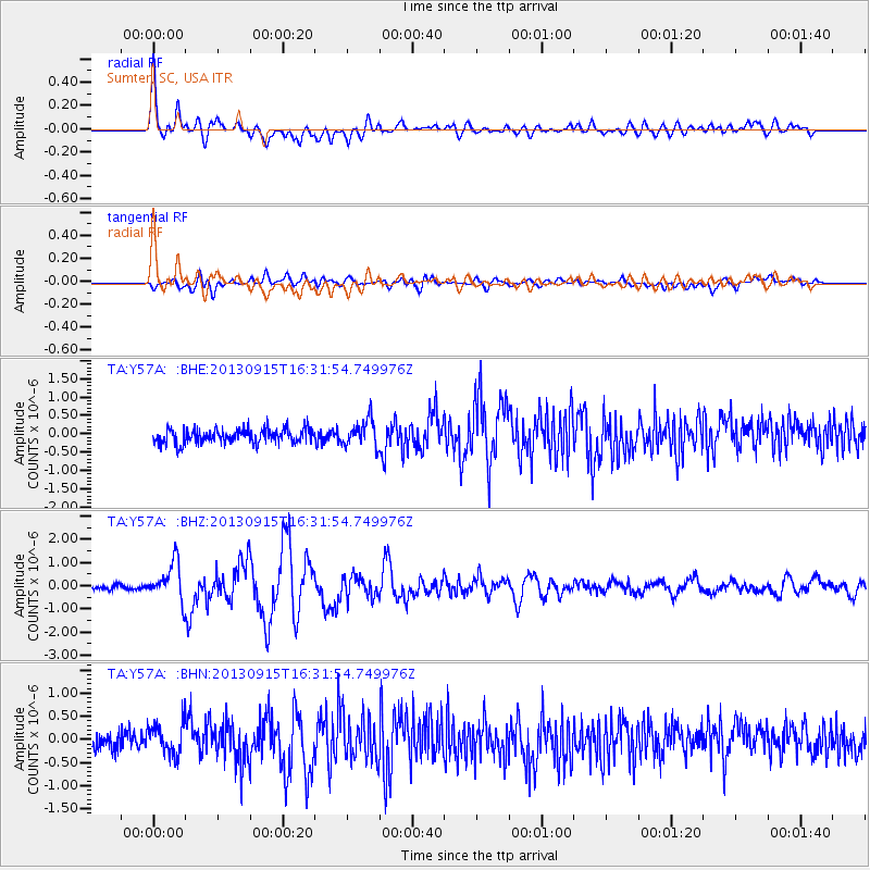
Earthquake location: Andreanof Islands, Aleutian Is.
Earthquake latitude/longitude: 51.6/-174.7
Earthquake time(UTC): 2013/09/15 (258) 16:21:37 GMT
Earthquake Depth: 24 km
Earthquake Magnitude: 6.1 MWW, 5.7 MI, 5.7 ML, 6.0 MWB, 6.1 MWC, 6.1 MWW
Earthquake Catalog/Contributor: NEIC PDE/NEIC COMCAT
Network: TA USArray Transportable Network (new EarthScope stations)
Station: Y57A Sumter, SC, USA
Lat/Lon: 34.02 N/80.39 W
Elevation: 56 m
Distance: 66.7 deg
Az: 64.421 deg
Baz: 317.337 deg
Ray Param: 0.057431817
Estimated Moho Depth: 33.5 km
Estimated Crust Vp/Vs: 1.73
Assumed Crust Vp: 6.419 km/s
Estimated Crust Vs: 3.711 km/s
Estimated Crust Poisson's Ratio: 0.25
Radial Match: 84.54126 %
Radial Bump: 400
Transverse Match: 71.592896 %
Transverse Bump: 400
SOD ConfigId: 626651
Insert Time: 2014-04-18 17:38:30.569 +0000
GWidth: 2.5
Max Bumps: 400
Tol: 0.001

Signal To Noise

ChannelStoNSTALTA
TA:Y57A: :BHZ:20130915T16:31:54.749976Z6.7144058.040015E-71.1974278E-7
TA:Y57A: :BHN:20130915T16:31:54.749976Z1.79192233.4848685E-71.9447654E-7
TA:Y57A: :BHE:20130915T16:31:54.749976Z1.82706983.6111715E-71.9764825E-7
Arrivals
Ps4.0 SECOND
PpPs14 SECOND
PsPs/PpSs18 SECOND