You are here: Home > Network List > TA - USArray Transportable Network (new EarthScope stations) Stations List
> Station Z41A Richland Creek Farm, El Dorado, AR, USA > Earthquake Result Viewer
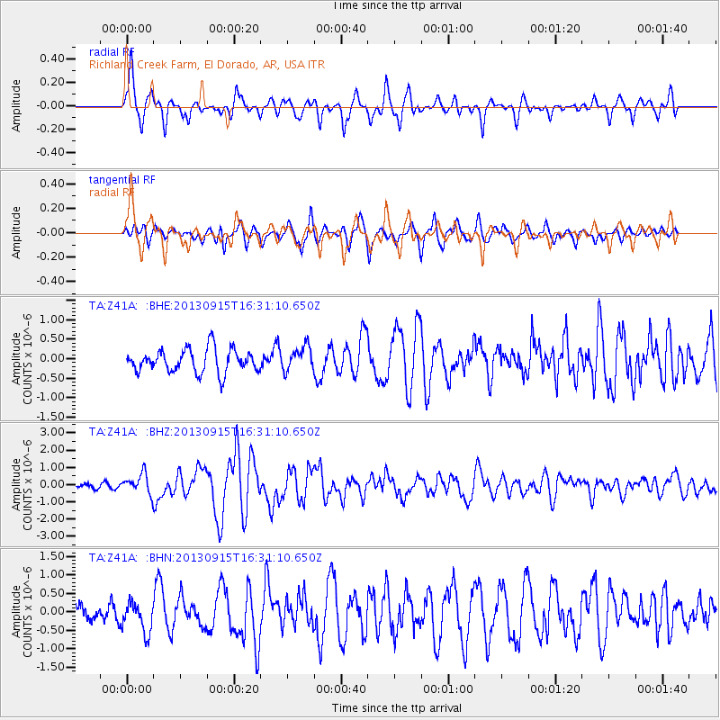
Z41A Richland Creek Farm, El Dorado, AR, USA - Earthquake Result Viewer
*The percent match for this event was below the threshold and hence no stack was calculated.
| Earthquake location: |
Andreanof Islands, Aleutian Is. |
| Earthquake latitude/longitude: |
51.6/-174.7 |
| Earthquake time(UTC): |
2013/09/15 (258) 16:21:37 GMT |
| Earthquake Depth: |
24 km |
| Earthquake Magnitude: |
6.1 MWW, 5.7 MI, 5.7 ML, 6.0 MWB, 6.1 MWC, 6.1 MWW |
| Earthquake Catalog/Contributor: |
NEIC PDE/NEIC COMCAT |
|
| Network: |
TA USArray Transportable Network (new EarthScope stations) |
| Station: |
Z41A Richland Creek Farm, El Dorado, AR, USA |
| Lat/Lon: |
33.26 N/92.80 W |
| Elevation: |
62 m |
|
| Distance: |
60.0 deg |
| Az: |
73.323 deg |
| Baz: |
314.483 deg |
| Ray Param: |
$rayparam |
*The percent match for this event was below the threshold and hence was not used in the summary stack. |
|
| Radial Match: |
76.07984 % |
| Radial Bump: |
382 |
| Transverse Match: |
69.25463 % |
| Transverse Bump: |
400 |
| SOD ConfigId: |
626651 |
| Insert Time: |
2014-04-18 17:38:37.443 +0000 |
| GWidth: |
2.5 |
| Max Bumps: |
400 |
| Tol: |
0.001 |
|
Signal To Noise
| Channel | StoN | STA | LTA |
| TA:Z41A: :BHZ:20130915T16:31:10.650Z | 3.8806136 | 5.8026785E-7 | 1.4952992E-7 |
| TA:Z41A: :BHN:20130915T16:31:10.650Z | 1.3195155 | 4.1630736E-7 | 3.1550016E-7 |
| TA:Z41A: :BHE:20130915T16:31:10.650Z | 1.0390099 | 3.106159E-7 | 2.9895372E-7 |
| Arrivals |
| Ps | |
| PpPs | |
| PsPs/PpSs | |


