Z50A Ashland, AL, USA - Earthquake Result Viewer
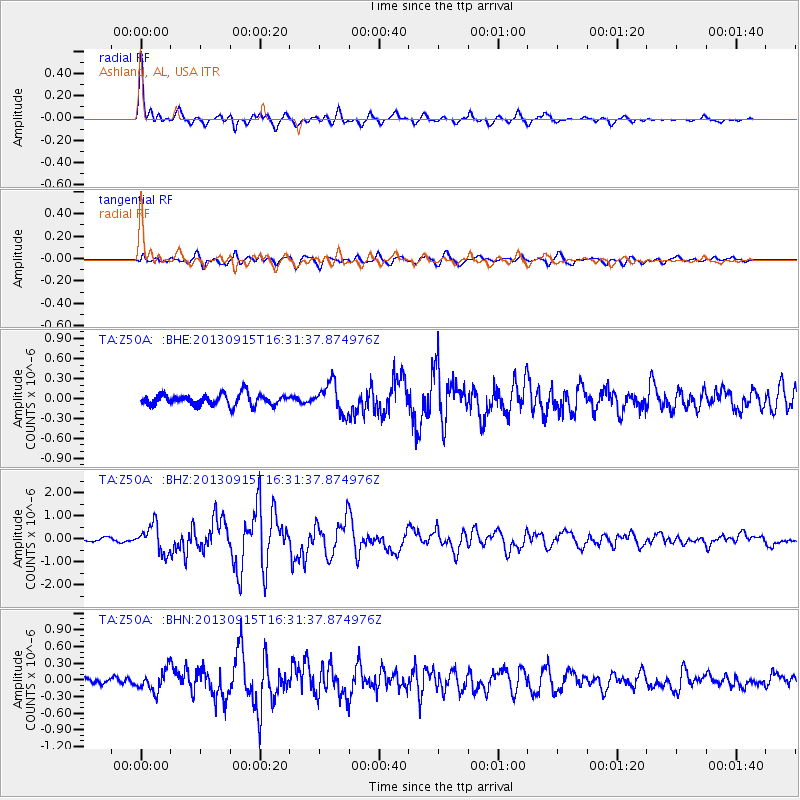
Earthquake location: Andreanof Islands, Aleutian Is.
Earthquake latitude/longitude: 51.6/-174.7
Earthquake time(UTC): 2013/09/15 (258) 16:21:37 GMT
Earthquake Depth: 24 km
Earthquake Magnitude: 6.1 MWW, 5.7 MI, 5.7 ML, 6.0 MWB, 6.1 MWC, 6.1 MWW
Earthquake Catalog/Contributor: NEIC PDE/NEIC COMCAT
Network: TA USArray Transportable Network (new EarthScope stations)
Station: Z50A Ashland, AL, USA
Lat/Lon: 33.25 N/85.92 W
Elevation: 370 m
Distance: 64.1 deg
Az: 68.689 deg
Baz: 316.066 deg
Ray Param: 0.059138436
Estimated Moho Depth: 49.75 km
Estimated Crust Vp/Vs: 1.83
Assumed Crust Vp: 6.719 km/s
Estimated Crust Vs: 3.682 km/s
Estimated Crust Poisson's Ratio: 0.29
Radial Match: 92.62009 %
Radial Bump: 400
Transverse Match: 83.58279 %
Transverse Bump: 400
SOD ConfigId: 626651
Insert Time: 2014-04-18 17:38:41.170 +0000
GWidth: 2.5
Max Bumps: 400
Tol: 0.001

Signal To Noise

ChannelStoNSTALTA
TA:Z50A: :BHZ:20130915T16:31:37.874976Z9.0754145.9985473E-76.609668E-8
TA:Z50A: :BHN:20130915T16:31:37.874976Z2.0920381.8463935E-78.8258126E-8
TA:Z50A: :BHE:20130915T16:31:37.874976Z2.60683582.2185277E-78.510423E-8
Arrivals
Ps6.4 SECOND
PpPs20 SECOND
PsPs/PpSs26 SECOND