MIAR Mount Ida, Arkansas, USA - Earthquake Result Viewer
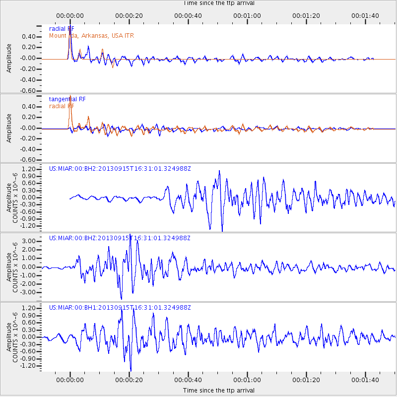
Earthquake location: Andreanof Islands, Aleutian Is.
Earthquake latitude/longitude: 51.6/-174.7
Earthquake time(UTC): 2013/09/15 (258) 16:21:37 GMT
Earthquake Depth: 24 km
Earthquake Magnitude: 6.1 MWW, 5.7 MI, 5.7 ML, 6.0 MWB, 6.1 MWC, 6.1 MWW
Earthquake Catalog/Contributor: NEIC PDE/NEIC COMCAT
Network: US United States National Seismic Network
Station: MIAR Mount Ida, Arkansas, USA
Lat/Lon: 34.55 N/93.58 W
Elevation: 207 m
Distance: 58.6 deg
Az: 72.772 deg
Baz: 313.773 deg
Ray Param: 0.06267934
Estimated Moho Depth: 43.75 km
Estimated Crust Vp/Vs: 1.90
Assumed Crust Vp: 6.498 km/s
Estimated Crust Vs: 3.411 km/s
Estimated Crust Poisson's Ratio: 0.31
Radial Match: 94.28903 %
Radial Bump: 350
Transverse Match: 88.2688 %
Transverse Bump: 400
SOD ConfigId: 626651
Insert Time: 2014-04-18 17:42:03.747 +0000
GWidth: 2.5
Max Bumps: 400
Tol: 0.001

Signal To Noise

ChannelStoNSTALTA
US:MIAR:00:BHZ:20130915T16:31:01.324988Z6.04797466.729002E-71.1126042E-7
US:MIAR:00:BH1:20130915T16:31:01.324988Z3.55419662.5830826E-77.267697E-8
US:MIAR:00:BH2:20130915T16:31:01.324988Z3.83017522.7495187E-77.178572E-8
Arrivals
Ps6.4 SECOND
PpPs19 SECOND
PsPs/PpSs25 SECOND