SDCO Great Sand Dunes National Park, Colorado, USA - Earthquake Result Viewer
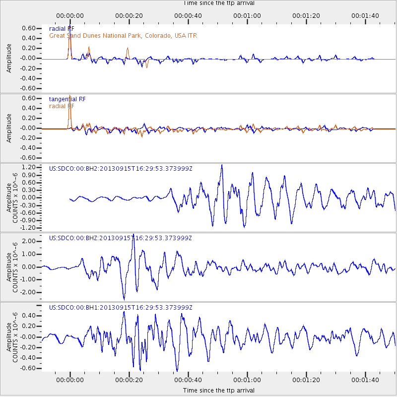
Earthquake location: Andreanof Islands, Aleutian Is.
Earthquake latitude/longitude: 51.6/-174.7
Earthquake time(UTC): 2013/09/15 (258) 16:21:37 GMT
Earthquake Depth: 24 km
Earthquake Magnitude: 6.1 MWW, 5.7 MI, 5.7 ML, 6.0 MWB, 6.1 MWC, 6.1 MWW
Earthquake Catalog/Contributor: NEIC PDE/NEIC COMCAT
Network: US United States National Seismic Network
Station: SDCO Great Sand Dunes National Park, Colorado, USA
Lat/Lon: 37.75 N/105.50 W
Elevation: 2569 m
Distance: 49.3 deg
Az: 77.773 deg
Baz: 309.703 deg
Ray Param: 0.06874071
Estimated Moho Depth: 47.0 km
Estimated Crust Vp/Vs: 1.70
Assumed Crust Vp: 6.316 km/s
Estimated Crust Vs: 3.71 km/s
Estimated Crust Poisson's Ratio: 0.24
Radial Match: 95.90717 %
Radial Bump: 244
Transverse Match: 88.34786 %
Transverse Bump: 400
SOD ConfigId: 626651
Insert Time: 2014-04-18 17:42:43.401 +0000
GWidth: 2.5
Max Bumps: 400
Tol: 0.001

Signal To Noise

ChannelStoNSTALTA
US:SDCO:00:BHZ:20130915T16:29:53.373999Z3.50228122.9067468E-78.299582E-8
US:SDCO:00:BH1:20130915T16:29:53.373999Z0.94550817.23846E-87.65563E-8
US:SDCO:00:BH2:20130915T16:29:53.373999Z2.7961411.6071081E-75.7475937E-8
Arrivals
Ps5.5 SECOND
PpPs19 SECOND
PsPs/PpSs25 SECOND