You are here: Home > Network List > TA - USArray Transportable Network (new EarthScope stations) Stations List
> Station O56A Blue Knob State Park, Imler, PA, USA > Earthquake Result Viewer
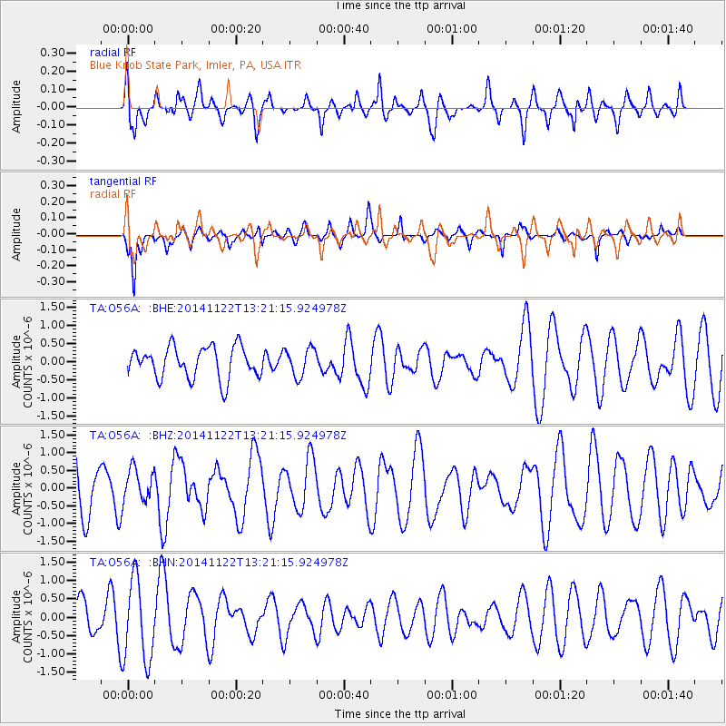
O56A Blue Knob State Park, Imler, PA, USA - Earthquake Result Viewer
*The percent match for this event was below the threshold and hence no stack was calculated.
| Earthquake location: |
Eastern Honshu, Japan |
| Earthquake latitude/longitude: |
36.6/137.9 |
| Earthquake time(UTC): |
2014/11/22 (326) 13:08:18 GMT |
| Earthquake Depth: |
10 km |
| Earthquake Magnitude: |
6.2 MWP |
| Earthquake Catalog/Contributor: |
NEIC PDE/NEIC COMCAT |
|
| Network: |
TA USArray Transportable Network (new EarthScope stations) |
| Station: |
O56A Blue Knob State Park, Imler, PA, USA |
| Lat/Lon: |
40.27 N/78.57 W |
| Elevation: |
684 m |
|
| Distance: |
96.4 deg |
| Az: |
27.244 deg |
| Baz: |
331.236 deg |
| Ray Param: |
$rayparam |
*The percent match for this event was below the threshold and hence was not used in the summary stack. |
|
| Radial Match: |
41.131245 % |
| Radial Bump: |
371 |
| Transverse Match: |
42.13273 % |
| Transverse Bump: |
283 |
| SOD ConfigId: |
3390531 |
| Insert Time: |
2019-04-15 04:08:01.151 +0000 |
| GWidth: |
2.5 |
| Max Bumps: |
400 |
| Tol: |
0.001 |
|
Signal To Noise
| Channel | StoN | STA | LTA |
| TA:O56A: :BHZ:20141122T13:21:15.924978Z | 0.6183483 | 4.643779E-7 | 7.509973E-7 |
| TA:O56A: :BHN:20141122T13:21:15.924978Z | 2.5715673 | 1.1080148E-6 | 4.3087138E-7 |
| TA:O56A: :BHE:20141122T13:21:15.924978Z | 0.8832532 | 3.854726E-7 | 4.3642365E-7 |
| Arrivals |
| Ps | |
| PpPs | |
| PsPs/PpSs | |


