You are here: Home > Network List > TA - USArray Transportable Network (new EarthScope stations) Stations List
> Station W57A Gilead, NC, USA > Earthquake Result Viewer
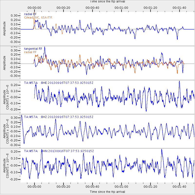
W57A Gilead, NC, USA - Earthquake Result Viewer
*The percent match for this event was below the threshold and hence no stack was calculated.
| Earthquake location: |
Southern East Pacific Rise |
| Earthquake latitude/longitude: |
-55.8/-124.2 |
| Earthquake time(UTC): |
2013/09/16 (259) 07:24:48 GMT |
| Earthquake Depth: |
10 km |
| Earthquake Magnitude: |
5.5 MWC, 5.5 MWC |
| Earthquake Catalog/Contributor: |
NEIC PDE/NEIC COMCAT |
|
| Network: |
TA USArray Transportable Network (new EarthScope stations) |
| Station: |
W57A Gilead, NC, USA |
| Lat/Lon: |
35.15 N/79.99 W |
| Elevation: |
85 m |
|
| Distance: |
98.1 deg |
| Az: |
35.218 deg |
| Baz: |
203.407 deg |
| Ray Param: |
$rayparam |
*The percent match for this event was below the threshold and hence was not used in the summary stack. |
|
| Radial Match: |
58.509243 % |
| Radial Bump: |
400 |
| Transverse Match: |
46.7158 % |
| Transverse Bump: |
400 |
| SOD ConfigId: |
626651 |
| Insert Time: |
2014-04-18 18:16:21.227 +0000 |
| GWidth: |
2.5 |
| Max Bumps: |
400 |
| Tol: |
0.001 |
|
Signal To Noise
| Channel | StoN | STA | LTA |
| TA:W57A: :BHZ:20130916T07:37:53.925015Z | 0.53269655 | 7.24593E-8 | 1.360236E-7 |
| TA:W57A: :BHN:20130916T07:37:53.925015Z | 1.4589492 | 8.3913505E-8 | 5.75164E-8 |
| TA:W57A: :BHE:20130916T07:37:53.925015Z | 0.97415453 | 7.383187E-8 | 7.579072E-8 |
| Arrivals |
| Ps | |
| PpPs | |
| PsPs/PpSs | |


