You are here: Home > Network List > US - United States National Seismic Network Stations List
> Station AMTX Amarillo, Texas, USA > Earthquake Result Viewer
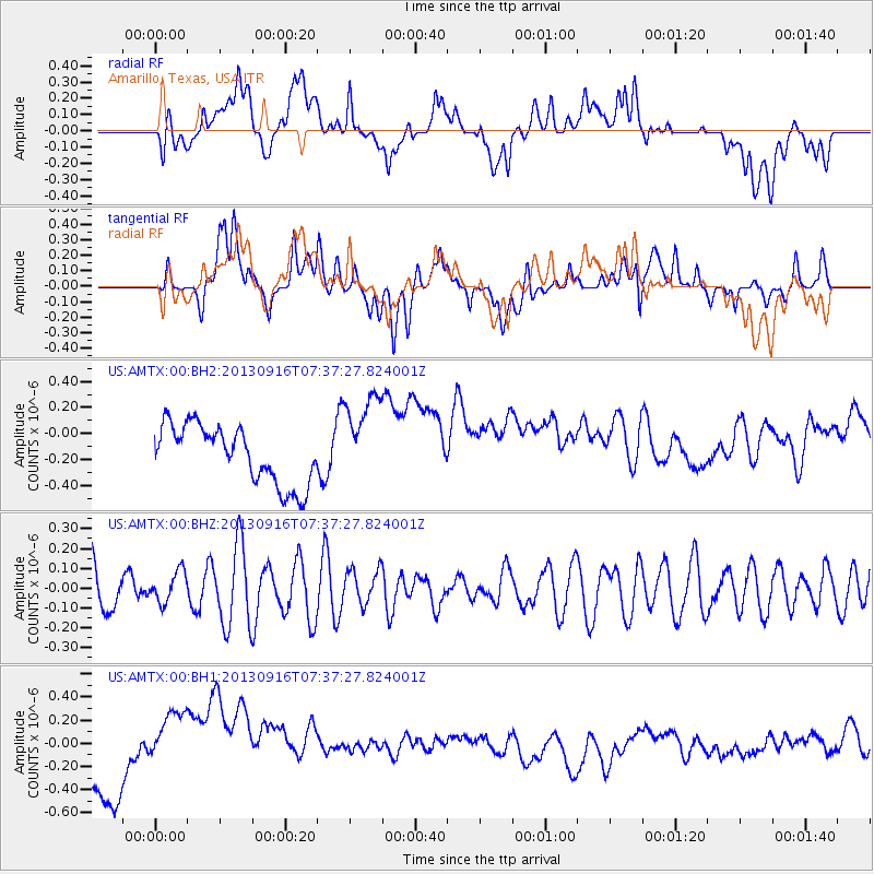
AMTX Amarillo, Texas, USA - Earthquake Result Viewer
*The percent match for this event was below the threshold and hence no stack was calculated.
| Earthquake location: |
Southern East Pacific Rise |
| Earthquake latitude/longitude: |
-55.8/-124.2 |
| Earthquake time(UTC): |
2013/09/16 (259) 07:24:48 GMT |
| Earthquake Depth: |
10 km |
| Earthquake Magnitude: |
5.5 MWC, 5.5 MWC |
| Earthquake Catalog/Contributor: |
NEIC PDE/NEIC COMCAT |
|
| Network: |
US United States National Seismic Network |
| Station: |
AMTX Amarillo, Texas, USA |
| Lat/Lon: |
34.53 N/101.41 W |
| Elevation: |
1010 m |
|
| Distance: |
92.1 deg |
| Az: |
18.629 deg |
| Baz: |
192.616 deg |
| Ray Param: |
$rayparam |
*The percent match for this event was below the threshold and hence was not used in the summary stack. |
|
| Radial Match: |
12.716106 % |
| Radial Bump: |
400 |
| Transverse Match: |
23.334692 % |
| Transverse Bump: |
400 |
| SOD ConfigId: |
626651 |
| Insert Time: |
2014-04-18 18:17:17.247 +0000 |
| GWidth: |
2.5 |
| Max Bumps: |
400 |
| Tol: |
0.001 |
|
Signal To Noise
| Channel | StoN | STA | LTA |
| US:AMTX:00:BHZ:20130916T07:37:27.824001Z | 0.6667784 | 7.8677544E-8 | 1.1799654E-7 |
| US:AMTX:00:BH1:20130916T07:37:27.824001Z | 2.6445055 | 4.4155252E-7 | 1.6696978E-7 |
| US:AMTX:00:BH2:20130916T07:37:27.824001Z | 1.4097006 | 3.194339E-7 | 2.2659697E-7 |
| Arrivals |
| Ps | |
| PpPs | |
| PsPs/PpSs | |


