You are here: Home > Network List > CI - Caltech Regional Seismic Network Stations List
> Station TIN Tinemaha, Big Pine, CA, USA > Earthquake Result Viewer
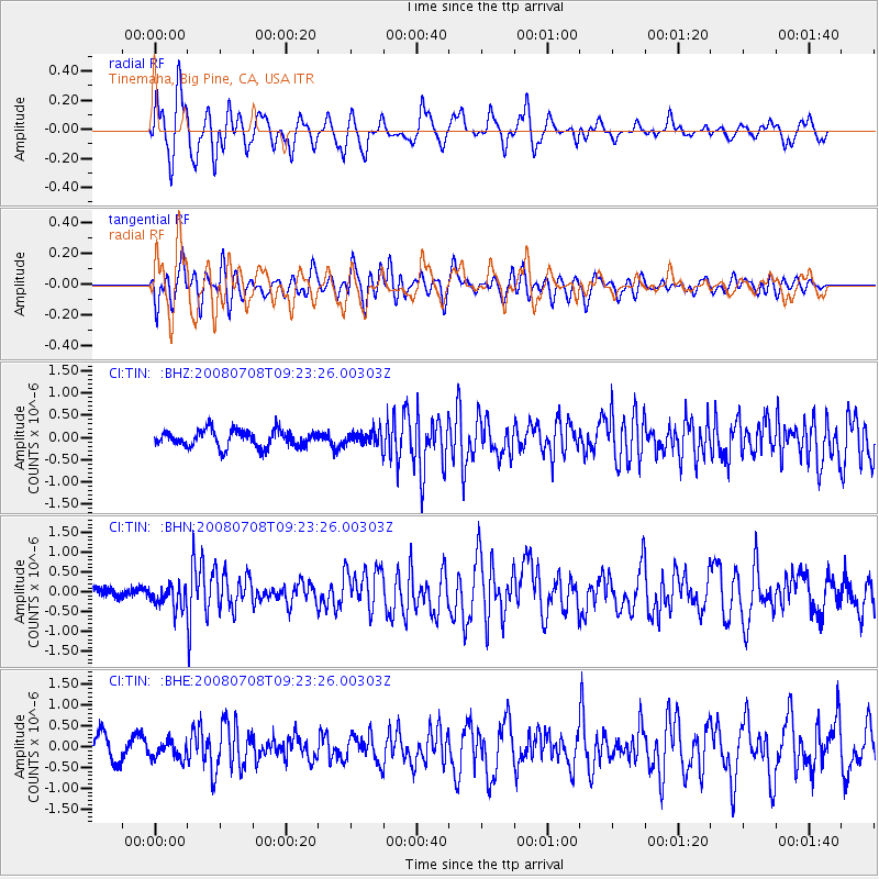
TIN Tinemaha, Big Pine, CA, USA - Earthquake Result Viewer
*The percent match for this event was below the threshold and hence no stack was calculated.
| Earthquake location: |
Southern Peru |
| Earthquake latitude/longitude: |
-16.0/-71.7 |
| Earthquake time(UTC): |
2008/07/08 (190) 09:13:07 GMT |
| Earthquake Depth: |
123 km |
| Earthquake Magnitude: |
5.8 MB, 6.2 MW, 6.2 MW |
| Earthquake Catalog/Contributor: |
WHDF/NEIC |
|
| Network: |
CI Caltech Regional Seismic Network |
| Station: |
TIN Tinemaha, Big Pine, CA, USA |
| Lat/Lon: |
37.05 N/118.23 W |
| Elevation: |
1197 m |
|
| Distance: |
68.6 deg |
| Az: |
321.444 deg |
| Baz: |
131.466 deg |
| Ray Param: |
$rayparam |
*The percent match for this event was below the threshold and hence was not used in the summary stack. |
|
| Radial Match: |
70.97663 % |
| Radial Bump: |
400 |
| Transverse Match: |
64.50601 % |
| Transverse Bump: |
400 |
| SOD ConfigId: |
2504 |
| Insert Time: |
2010-02-25 20:52:16.756 +0000 |
| GWidth: |
2.5 |
| Max Bumps: |
400 |
| Tol: |
0.001 |
|
Signal To Noise
| Channel | StoN | STA | LTA |
| CI:TIN: :BHN:20080708T09:23:26.00303Z | 1.6964475 | 2.8155858E-7 | 1.6596954E-7 |
| CI:TIN: :BHE:20080708T09:23:26.00303Z | 0.8424001 | 1.9901155E-7 | 2.3624352E-7 |
| CI:TIN: :BHZ:20080708T09:23:26.00303Z | 0.8464947 | 1.575048E-7 | 1.860671E-7 |
| Arrivals |
| Ps | |
| PpPs | |
| PsPs/PpSs | |


