You are here: Home > Network List > G - GEOSCOPE Stations List
> Station INU Inuyama, Japan > Earthquake Result Viewer
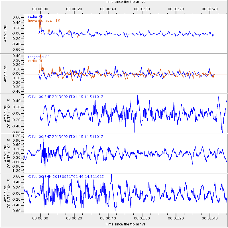
INU Inuyama, Japan - Earthquake Result Viewer
*The percent match for this event was below the threshold and hence no stack was calculated.
| Earthquake location: |
Flores Sea |
| Earthquake latitude/longitude: |
-7.3/120.0 |
| Earthquake time(UTC): |
2013/09/21 (264) 01:39:15 GMT |
| Earthquake Depth: |
550 km |
| Earthquake Magnitude: |
6.1 MWW, 6.0 MWC, 6.1 MWW, 6.1 MWC, 6.1 MWB |
| Earthquake Catalog/Contributor: |
NEIC PDE/NEIC COMCAT |
|
| Network: |
G GEOSCOPE |
| Station: |
INU Inuyama, Japan |
| Lat/Lon: |
35.35 N/137.03 E |
| Elevation: |
132 m |
|
| Distance: |
45.4 deg |
| Az: |
19.64 deg |
| Baz: |
204.07 deg |
| Ray Param: |
$rayparam |
*The percent match for this event was below the threshold and hence was not used in the summary stack. |
|
| Radial Match: |
49.12809 % |
| Radial Bump: |
339 |
| Transverse Match: |
58.14341 % |
| Transverse Bump: |
400 |
| SOD ConfigId: |
626651 |
| Insert Time: |
2014-04-18 18:30:57.101 +0000 |
| GWidth: |
2.5 |
| Max Bumps: |
400 |
| Tol: |
0.001 |
|
Signal To Noise
| Channel | StoN | STA | LTA |
| G:INU:00:BHZ:20130921T01:46:14.51101Z | 2.852096 | 4.8858743E-7 | 1.713082E-7 |
| G:INU:00:BHN:20130921T01:46:14.51101Z | 2.172099 | 2.4899612E-7 | 1.1463386E-7 |
| G:INU:00:BHE:20130921T01:46:14.51101Z | 1.3150138 | 1.907131E-7 | 1.4502746E-7 |
| Arrivals |
| Ps | |
| PpPs | |
| PsPs/PpSs | |


