You are here: Home > Network List > IU - Global Seismograph Network (GSN - IRIS/USGS) Stations List
> Station JOHN Johnston Island, USA > Earthquake Result Viewer
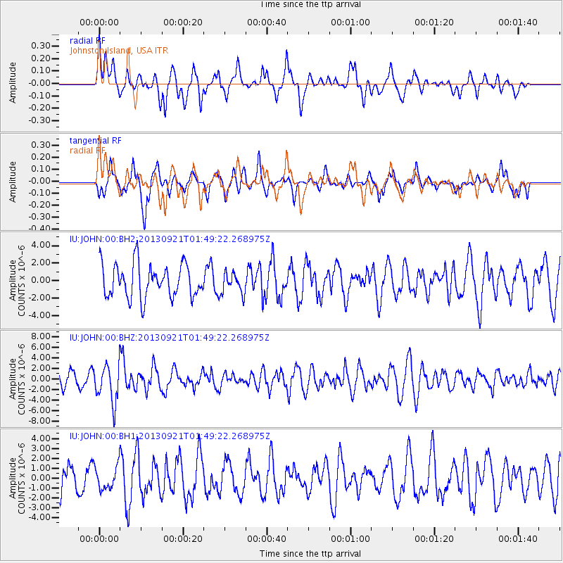
JOHN Johnston Island, USA - Earthquake Result Viewer
*The percent match for this event was below the threshold and hence no stack was calculated.
| Earthquake location: |
Flores Sea |
| Earthquake latitude/longitude: |
-7.3/120.0 |
| Earthquake time(UTC): |
2013/09/21 (264) 01:39:15 GMT |
| Earthquake Depth: |
550 km |
| Earthquake Magnitude: |
6.1 MWW, 6.0 MWC, 6.1 MWW, 6.1 MWC, 6.1 MWB |
| Earthquake Catalog/Contributor: |
NEIC PDE/NEIC COMCAT |
|
| Network: |
IU Global Seismograph Network (GSN - IRIS/USGS) |
| Station: |
JOHN Johnston Island, USA |
| Lat/Lon: |
16.73 N/169.53 W |
| Elevation: |
2.0 m |
|
| Distance: |
73.6 deg |
| Az: |
70.236 deg |
| Baz: |
256.967 deg |
| Ray Param: |
$rayparam |
*The percent match for this event was below the threshold and hence was not used in the summary stack. |
|
| Radial Match: |
52.286083 % |
| Radial Bump: |
400 |
| Transverse Match: |
41.037052 % |
| Transverse Bump: |
344 |
| SOD ConfigId: |
626651 |
| Insert Time: |
2014-04-18 18:32:58.060 +0000 |
| GWidth: |
2.5 |
| Max Bumps: |
400 |
| Tol: |
0.001 |
|
Signal To Noise
| Channel | StoN | STA | LTA |
| IU:JOHN:00:BHZ:20130921T01:49:22.268975Z | 2.613528 | 3.6482231E-6 | 1.3958997E-6 |
| IU:JOHN:00:BH1:20130921T01:49:22.268975Z | 0.6324645 | 1.1391479E-6 | 1.8011254E-6 |
| IU:JOHN:00:BH2:20130921T01:49:22.268975Z | 0.6182549 | 1.1809792E-6 | 1.9101817E-6 |
| Arrivals |
| Ps | |
| PpPs | |
| PsPs/PpSs | |


