You are here: Home > Network List > IU - Global Seismograph Network (GSN - IRIS/USGS) Stations List
> Station MAJO Matsushiro, Japan > Earthquake Result Viewer
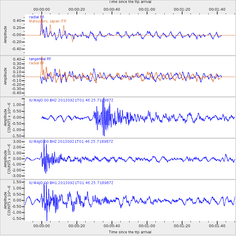
MAJO Matsushiro, Japan - Earthquake Result Viewer
*The percent match for this event was below the threshold and hence no stack was calculated.
| Earthquake location: |
Flores Sea |
| Earthquake latitude/longitude: |
-7.3/120.0 |
| Earthquake time(UTC): |
2013/09/21 (264) 01:39:15 GMT |
| Earthquake Depth: |
550 km |
| Earthquake Magnitude: |
6.1 MWW, 6.0 MWC, 6.1 MWW, 6.1 MWC, 6.1 MWB |
| Earthquake Catalog/Contributor: |
NEIC PDE/NEIC COMCAT |
|
| Network: |
IU Global Seismograph Network (GSN - IRIS/USGS) |
| Station: |
MAJO Matsushiro, Japan |
| Lat/Lon: |
36.55 N/138.20 E |
| Elevation: |
405 m |
|
| Distance: |
46.9 deg |
| Az: |
20.154 deg |
| Baz: |
205.113 deg |
| Ray Param: |
$rayparam |
*The percent match for this event was below the threshold and hence was not used in the summary stack. |
|
| Radial Match: |
57.173126 % |
| Radial Bump: |
303 |
| Transverse Match: |
50.868137 % |
| Transverse Bump: |
380 |
| SOD ConfigId: |
626651 |
| Insert Time: |
2014-04-18 18:33:06.148 +0000 |
| GWidth: |
2.5 |
| Max Bumps: |
400 |
| Tol: |
0.001 |
|
Signal To Noise
| Channel | StoN | STA | LTA |
| IU:MAJO:00:BHZ:20130921T01:46:25.718987Z | 6.906479 | 1.2198154E-6 | 1.7661901E-7 |
| IU:MAJO:00:BH1:20130921T01:46:25.718987Z | 2.0634284 | 6.2907446E-7 | 3.048686E-7 |
| IU:MAJO:00:BH2:20130921T01:46:25.718987Z | 4.1878185 | 4.6019971E-7 | 1.0989009E-7 |
| Arrivals |
| Ps | |
| PpPs | |
| PsPs/PpSs | |


