You are here: Home > Network List > AZ - ANZA Regional Network Stations List
> Station SMER AZ.SMER > Earthquake Result Viewer
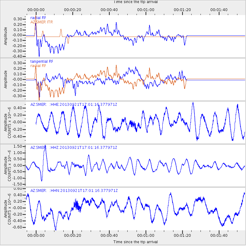
SMER AZ.SMER - Earthquake Result Viewer
*The percent match for this event was below the threshold and hence no stack was calculated.
| Earthquake location: |
South Of Kermadec Islands |
| Earthquake latitude/longitude: |
-33.5/-178.0 |
| Earthquake time(UTC): |
2013/09/21 (264) 16:48:58 GMT |
| Earthquake Depth: |
10 km |
| Earthquake Magnitude: |
5.8 MWW, 5.7 MWC, 5.8 MWW |
| Earthquake Catalog/Contributor: |
NEIC PDE/NEIC COMCAT |
|
| Network: |
AZ ANZA Regional Network |
| Station: |
SMER AZ.SMER |
| Lat/Lon: |
33.46 N/117.17 W |
| Elevation: |
355 m |
|
| Distance: |
87.8 deg |
| Az: |
46.943 deg |
| Baz: |
226.906 deg |
| Ray Param: |
$rayparam |
*The percent match for this event was below the threshold and hence was not used in the summary stack. |
|
| Radial Match: |
58.982254 % |
| Radial Bump: |
400 |
| Transverse Match: |
54.61672 % |
| Transverse Bump: |
400 |
| SOD ConfigId: |
626651 |
| Insert Time: |
2014-04-18 18:38:44.587 +0000 |
| GWidth: |
2.5 |
| Max Bumps: |
400 |
| Tol: |
0.001 |
|
Signal To Noise
| Channel | StoN | STA | LTA |
| AZ:SMER: :HHZ:20130921T17:01:16.377971Z | 4.6487346 | 6.2365837E-7 | 1.341566E-7 |
| AZ:SMER: :HHN:20130921T17:01:16.377971Z | 1.597808 | 2.965995E-7 | 1.8562899E-7 |
| AZ:SMER: :HHE:20130921T17:01:16.377971Z | 1.1608138 | 2.55127E-7 | 2.1978288E-7 |
| Arrivals |
| Ps | |
| PpPs | |
| PsPs/PpSs | |


