You are here: Home > Network List > TA - USArray Transportable Network (new EarthScope stations) Stations List
> Station T25A Trinidad, CO, USA > Earthquake Result Viewer
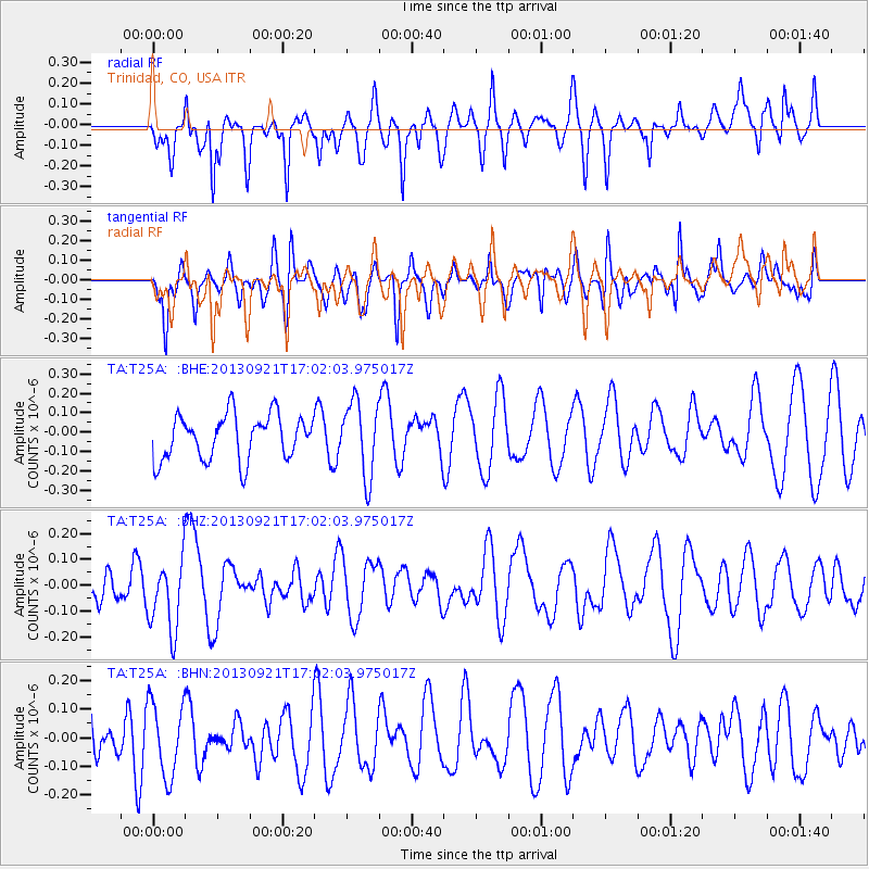
T25A Trinidad, CO, USA - Earthquake Result Viewer
*The percent match for this event was below the threshold and hence no stack was calculated.
| Earthquake location: |
South Of Kermadec Islands |
| Earthquake latitude/longitude: |
-33.5/-178.0 |
| Earthquake time(UTC): |
2013/09/21 (264) 16:48:58 GMT |
| Earthquake Depth: |
10 km |
| Earthquake Magnitude: |
5.8 MWW, 5.7 MWC, 5.8 MWW |
| Earthquake Catalog/Contributor: |
NEIC PDE/NEIC COMCAT |
|
| Network: |
TA USArray Transportable Network (new EarthScope stations) |
| Station: |
T25A Trinidad, CO, USA |
| Lat/Lon: |
37.14 N/104.41 W |
| Elevation: |
2017 m |
|
| Distance: |
98.2 deg |
| Az: |
50.76 deg |
| Baz: |
234.071 deg |
| Ray Param: |
$rayparam |
*The percent match for this event was below the threshold and hence was not used in the summary stack. |
|
| Radial Match: |
59.064545 % |
| Radial Bump: |
400 |
| Transverse Match: |
64.934875 % |
| Transverse Bump: |
400 |
| SOD ConfigId: |
626651 |
| Insert Time: |
2014-04-18 18:45:37.656 +0000 |
| GWidth: |
2.5 |
| Max Bumps: |
400 |
| Tol: |
0.001 |
|
Signal To Noise
| Channel | StoN | STA | LTA |
| TA:T25A: :BHZ:20130921T17:02:03.975017Z | 0.9095072 | 1.383362E-7 | 1.5210017E-7 |
| TA:T25A: :BHN:20130921T17:02:03.975017Z | 1.0080136 | 1.3003192E-7 | 1.2899818E-7 |
| TA:T25A: :BHE:20130921T17:02:03.975017Z | 1.6537815 | 1.9129153E-7 | 1.1566917E-7 |
| Arrivals |
| Ps | |
| PpPs | |
| PsPs/PpSs | |


