You are here: Home > Network List > TA - USArray Transportable Network (new EarthScope stations) Stations List
> Station W56A Indian Trail, NC, USA > Earthquake Result Viewer
W56A Indian Trail, NC, USA - Earthquake Result Viewer
*The percent match for this event was below the threshold and hence no stack was calculated.
| Earthquake location: |
Off Coast Of Oregon |
| Earthquake latitude/longitude: |
43.8/-128.5 |
| Earthquake time(UTC): |
2014/11/23 (327) 11:01:25 GMT |
| Earthquake Depth: |
14 km |
| Earthquake Magnitude: |
5.2 MW, 5.3 mb, 4.7 MS |
| Earthquake Catalog/Contributor: |
ISC/ISC |
|
| Network: |
TA USArray Transportable Network (new EarthScope stations) |
| Station: |
W56A Indian Trail, NC, USA |
| Lat/Lon: |
35.13 N/80.58 W |
| Elevation: |
177 m |
|
| Distance: |
37.6 deg |
| Az: |
86.615 deg |
| Baz: |
298.167 deg |
| Ray Param: |
$rayparam |
*The percent match for this event was below the threshold and hence was not used in the summary stack. |
|
| Radial Match: |
53.311726 % |
| Radial Bump: |
400 |
| Transverse Match: |
73.023964 % |
| Transverse Bump: |
400 |
| SOD ConfigId: |
3390531 |
| Insert Time: |
2019-04-15 04:32:01.776 +0000 |
| GWidth: |
2.5 |
| Max Bumps: |
400 |
| Tol: |
0.001 |
|
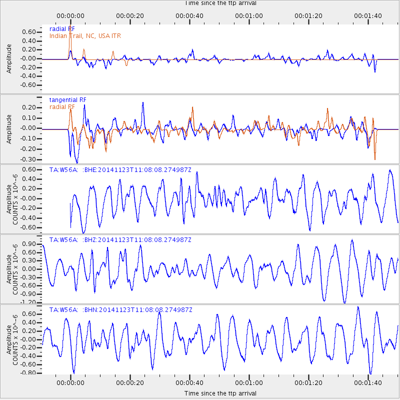
Signal To Noise
| Channel | StoN | STA | LTA |
| TA:W56A: :BHZ:20141123T11:08:08.274987Z | 0.93547904 | 3.615548E-7 | 3.8649162E-7 |
| TA:W56A: :BHN:20141123T11:08:08.274987Z | 1.3376566 | 3.9924828E-7 | 2.9846842E-7 |
| TA:W56A: :BHE:20141123T11:08:08.274987Z | 0.8859363 | 2.531399E-7 | 2.8573146E-7 |
| Arrivals |
| Ps | |
| PpPs | |
| PsPs/PpSs | |


