You are here: Home > Network List > TA - USArray Transportable Network (new EarthScope stations) Stations List
> Station L53A Girard, PA, USA > Earthquake Result Viewer
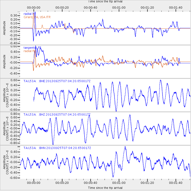
L53A Girard, PA, USA - Earthquake Result Viewer
*The percent match for this event was below the threshold and hence no stack was calculated.
| Earthquake location: |
Southern East Pacific Rise |
| Earthquake latitude/longitude: |
-50.0/-113.7 |
| Earthquake time(UTC): |
2013/09/25 (268) 06:51:24 GMT |
| Earthquake Depth: |
10 km |
| Earthquake Magnitude: |
6.1 MWW, 6.0 MWC, 6.1 MWW, 6.1 MWC |
| Earthquake Catalog/Contributor: |
NEIC PDE/NEIC COMCAT |
|
| Network: |
TA USArray Transportable Network (new EarthScope stations) |
| Station: |
L53A Girard, PA, USA |
| Lat/Lon: |
41.95 N/80.26 W |
| Elevation: |
355 m |
|
| Distance: |
96.1 deg |
| Az: |
24.449 deg |
| Baz: |
201.001 deg |
| Ray Param: |
$rayparam |
*The percent match for this event was below the threshold and hence was not used in the summary stack. |
|
| Radial Match: |
33.75196 % |
| Radial Bump: |
400 |
| Transverse Match: |
47.295708 % |
| Transverse Bump: |
400 |
| SOD ConfigId: |
626651 |
| Insert Time: |
2014-04-18 19:42:24.172 +0000 |
| GWidth: |
2.5 |
| Max Bumps: |
400 |
| Tol: |
0.001 |
|
Signal To Noise
| Channel | StoN | STA | LTA |
| TA:L53A: :BHZ:20130925T07:04:20.650017Z | 0.58312666 | 1.3233704E-7 | 2.269439E-7 |
| TA:L53A: :BHN:20130925T07:04:20.650017Z | 0.40424398 | 1.02154914E-7 | 2.527061E-7 |
| TA:L53A: :BHE:20130925T07:04:20.650017Z | 0.8025494 | 1.6404027E-7 | 2.0439897E-7 |
| Arrivals |
| Ps | |
| PpPs | |
| PsPs/PpSs | |


