You are here: Home > Network List > TA - USArray Transportable Network (new EarthScope stations) Stations List
> Station S49A Springfield, KY, USA > Earthquake Result Viewer
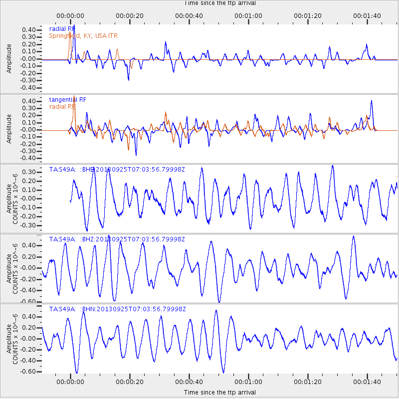
S49A Springfield, KY, USA - Earthquake Result Viewer
*The percent match for this event was below the threshold and hence no stack was calculated.
| Earthquake location: |
Southern East Pacific Rise |
| Earthquake latitude/longitude: |
-50.0/-113.7 |
| Earthquake time(UTC): |
2013/09/25 (268) 06:51:24 GMT |
| Earthquake Depth: |
10 km |
| Earthquake Magnitude: |
6.1 MWW, 6.0 MWC, 6.1 MWW, 6.1 MWC |
| Earthquake Catalog/Contributor: |
NEIC PDE/NEIC COMCAT |
|
| Network: |
TA USArray Transportable Network (new EarthScope stations) |
| Station: |
S49A Springfield, KY, USA |
| Lat/Lon: |
37.78 N/85.29 W |
| Elevation: |
230 m |
|
| Distance: |
90.9 deg |
| Az: |
22.183 deg |
| Baz: |
197.926 deg |
| Ray Param: |
$rayparam |
*The percent match for this event was below the threshold and hence was not used in the summary stack. |
|
| Radial Match: |
73.443054 % |
| Radial Bump: |
400 |
| Transverse Match: |
72.19164 % |
| Transverse Bump: |
400 |
| SOD ConfigId: |
626651 |
| Insert Time: |
2014-04-18 19:44:00.730 +0000 |
| GWidth: |
2.5 |
| Max Bumps: |
400 |
| Tol: |
0.001 |
|
Signal To Noise
| Channel | StoN | STA | LTA |
| TA:S49A: :BHZ:20130925T07:03:56.79998Z | 1.25177 | 2.5507904E-7 | 2.0377469E-7 |
| TA:S49A: :BHN:20130925T07:03:56.79998Z | 2.6476748 | 3.805802E-7 | 1.4374127E-7 |
| TA:S49A: :BHE:20130925T07:03:56.79998Z | 0.6948511 | 1.2282064E-7 | 1.767582E-7 |
| Arrivals |
| Ps | |
| PpPs | |
| PsPs/PpSs | |


