You are here: Home > Network List > US - United States National Seismic Network Stations List
> Station ERPA Erie, Pennsylvania, USA > Earthquake Result Viewer
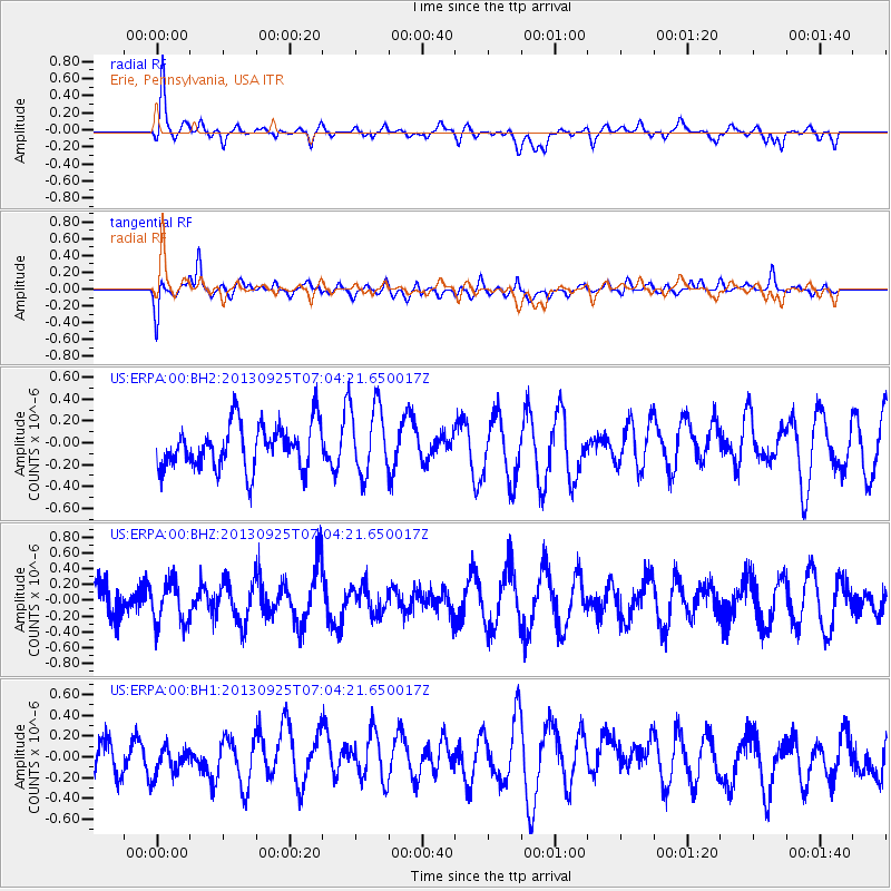
ERPA Erie, Pennsylvania, USA - Earthquake Result Viewer
*The percent match for this event was below the threshold and hence no stack was calculated.
| Earthquake location: |
Southern East Pacific Rise |
| Earthquake latitude/longitude: |
-50.0/-113.7 |
| Earthquake time(UTC): |
2013/09/25 (268) 06:51:24 GMT |
| Earthquake Depth: |
10 km |
| Earthquake Magnitude: |
6.1 MWW, 6.0 MWC, 6.1 MWW, 6.1 MWC |
| Earthquake Catalog/Contributor: |
NEIC PDE/NEIC COMCAT |
|
| Network: |
US United States National Seismic Network |
| Station: |
ERPA Erie, Pennsylvania, USA |
| Lat/Lon: |
42.12 N/79.99 W |
| Elevation: |
306 m |
|
| Distance: |
96.3 deg |
| Az: |
24.579 deg |
| Baz: |
201.167 deg |
| Ray Param: |
$rayparam |
*The percent match for this event was below the threshold and hence was not used in the summary stack. |
|
| Radial Match: |
74.70927 % |
| Radial Bump: |
400 |
| Transverse Match: |
50.284515 % |
| Transverse Bump: |
400 |
| SOD ConfigId: |
626651 |
| Insert Time: |
2014-04-18 19:45:55.474 +0000 |
| GWidth: |
2.5 |
| Max Bumps: |
400 |
| Tol: |
0.001 |
|
Signal To Noise
| Channel | StoN | STA | LTA |
| US:ERPA:00:BHZ:20130925T07:04:21.650017Z | 1.2048434 | 2.7104886E-7 | 2.2496606E-7 |
| US:ERPA:00:BH1:20130925T07:04:21.650017Z | 0.6571363 | 1.2813351E-7 | 1.9498772E-7 |
| US:ERPA:00:BH2:20130925T07:04:21.650017Z | 1.561653 | 3.2224673E-7 | 2.0634977E-7 |
| Arrivals |
| Ps | |
| PpPs | |
| PsPs/PpSs | |


