You are here: Home > Network List > CI - Caltech Regional Seismic Network Stations List
> Station TIN Tinemaha, California, USA > Earthquake Result Viewer
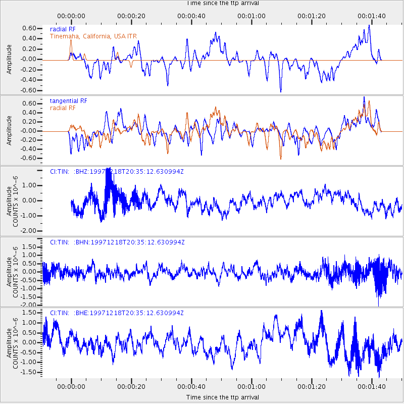
TIN Tinemaha, California, USA - Earthquake Result Viewer
*The percent match for this event was below the threshold and hence no stack was calculated.
| Earthquake location: |
Mariana Islands |
| Earthquake latitude/longitude: |
14.7/144.7 |
| Earthquake time(UTC): |
1997/12/18 (352) 20:23:02 GMT |
| Earthquake Depth: |
33 km |
| Earthquake Magnitude: |
5.5 MB, 5.4 MS, 5.9 UNKNOWN, 5.8 MW |
| Earthquake Catalog/Contributor: |
WHDF/NEIC |
|
| Network: |
CI Caltech Regional Seismic Network |
| Station: |
TIN Tinemaha, California, USA |
| Lat/Lon: |
37.05 N/118.23 W |
| Elevation: |
1164 m |
|
| Distance: |
86.8 deg |
| Az: |
52.662 deg |
| Baz: |
285.913 deg |
| Ray Param: |
$rayparam |
*The percent match for this event was below the threshold and hence was not used in the summary stack. |
|
| Radial Match: |
64.06061 % |
| Radial Bump: |
400 |
| Transverse Match: |
58.980164 % |
| Transverse Bump: |
348 |
| SOD ConfigId: |
4480 |
| Insert Time: |
2010-02-25 20:52:20.857 +0000 |
| GWidth: |
2.5 |
| Max Bumps: |
400 |
| Tol: |
0.001 |
|
Signal To Noise
| Channel | StoN | STA | LTA |
| CI:TIN: :BHN:19971218T20:35:12.630994Z | 0.4339406 | 1.9865354E-7 | 4.577897E-7 |
| CI:TIN: :BHE:19971218T20:35:12.630994Z | 0.62565494 | 3.4681992E-7 | 5.54331E-7 |
| CI:TIN: :BHZ:19971218T20:35:12.630994Z | 0.76533276 | 5.224441E-7 | 6.826366E-7 |
| Arrivals |
| Ps | |
| PpPs | |
| PsPs/PpSs | |


