You are here: Home > Network List > TA - USArray Transportable Network (new EarthScope stations) Stations List
> Station P59A Jarrettsville, MD, USA > Earthquake Result Viewer
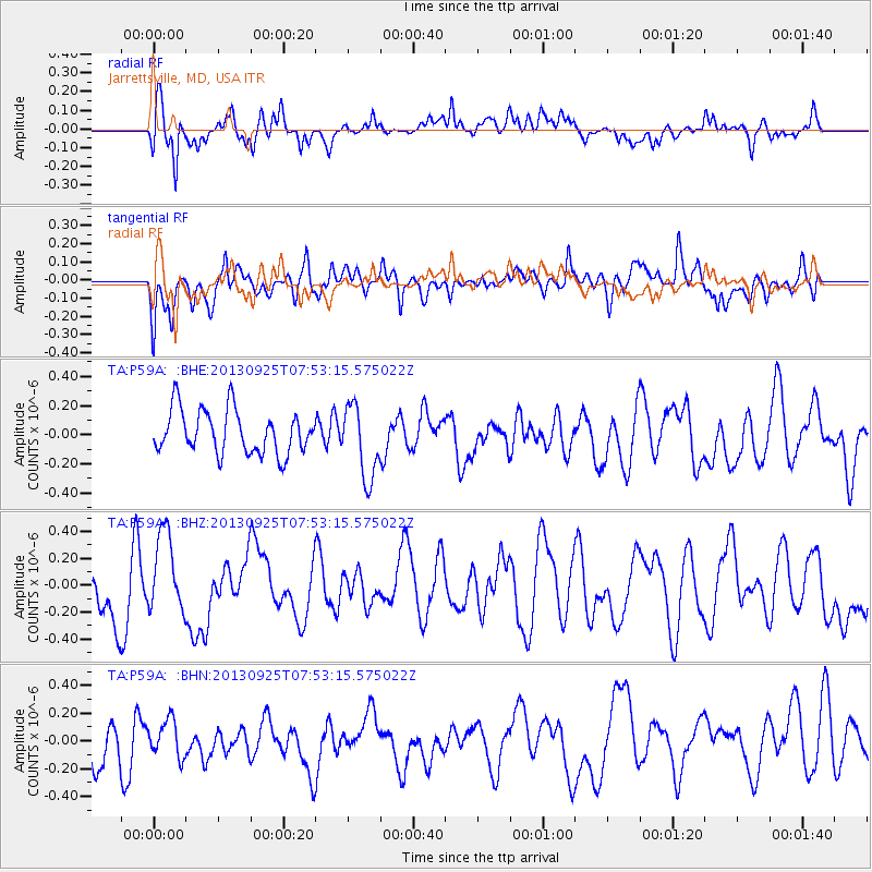
P59A Jarrettsville, MD, USA - Earthquake Result Viewer
*The percent match for this event was below the threshold and hence no stack was calculated.
| Earthquake location: |
Southern East Pacific Rise |
| Earthquake latitude/longitude: |
-50.0/-114.0 |
| Earthquake time(UTC): |
2013/09/25 (268) 07:40:23 GMT |
| Earthquake Depth: |
10 km |
| Earthquake Magnitude: |
5.5 MWC, 5.5 MWC |
| Earthquake Catalog/Contributor: |
NEIC PDE/NEIC COMCAT |
|
| Network: |
TA USArray Transportable Network (new EarthScope stations) |
| Station: |
P59A Jarrettsville, MD, USA |
| Lat/Lon: |
39.61 N/76.43 W |
| Elevation: |
157 m |
|
| Distance: |
95.2 deg |
| Az: |
28.216 deg |
| Baz: |
203.247 deg |
| Ray Param: |
$rayparam |
*The percent match for this event was below the threshold and hence was not used in the summary stack. |
|
| Radial Match: |
66.50212 % |
| Radial Bump: |
400 |
| Transverse Match: |
64.2911 % |
| Transverse Bump: |
400 |
| SOD ConfigId: |
626651 |
| Insert Time: |
2014-04-18 19:59:41.228 +0000 |
| GWidth: |
2.5 |
| Max Bumps: |
400 |
| Tol: |
0.001 |
|
Signal To Noise
| Channel | StoN | STA | LTA |
| TA:P59A: :BHZ:20130925T07:53:15.575022Z | 0.917728 | 2.9871796E-7 | 3.2549727E-7 |
| TA:P59A: :BHN:20130925T07:53:15.575022Z | 0.7681075 | 1.3353579E-7 | 1.738504E-7 |
| TA:P59A: :BHE:20130925T07:53:15.575022Z | 1.6809798 | 2.511077E-7 | 1.4938173E-7 |
| Arrivals |
| Ps | |
| PpPs | |
| PsPs/PpSs | |


