You are here: Home > Network List > TA - USArray Transportable Network (new EarthScope stations) Stations List
> Station X59A McDuffie Farm, Elizabethtown, NC, USA > Earthquake Result Viewer
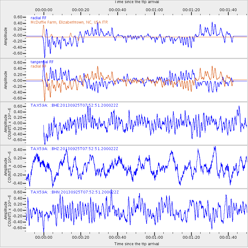
X59A McDuffie Farm, Elizabethtown, NC, USA - Earthquake Result Viewer
*The percent match for this event was below the threshold and hence no stack was calculated.
| Earthquake location: |
Southern East Pacific Rise |
| Earthquake latitude/longitude: |
-50.0/-114.0 |
| Earthquake time(UTC): |
2013/09/25 (268) 07:40:23 GMT |
| Earthquake Depth: |
10 km |
| Earthquake Magnitude: |
5.5 MWC, 5.5 MWC |
| Earthquake Catalog/Contributor: |
NEIC PDE/NEIC COMCAT |
|
| Network: |
TA USArray Transportable Network (new EarthScope stations) |
| Station: |
X59A McDuffie Farm, Elizabethtown, NC, USA |
| Lat/Lon: |
34.57 N/78.60 W |
| Elevation: |
29 m |
|
| Distance: |
89.9 deg |
| Az: |
28.545 deg |
| Baz: |
201.928 deg |
| Ray Param: |
$rayparam |
*The percent match for this event was below the threshold and hence was not used in the summary stack. |
|
| Radial Match: |
52.805164 % |
| Radial Bump: |
400 |
| Transverse Match: |
41.8752 % |
| Transverse Bump: |
400 |
| SOD ConfigId: |
626651 |
| Insert Time: |
2014-04-18 20:01:36.609 +0000 |
| GWidth: |
2.5 |
| Max Bumps: |
400 |
| Tol: |
0.001 |
|
Signal To Noise
| Channel | StoN | STA | LTA |
| TA:X59A: :BHZ:20130925T07:52:51.200022Z | 1.0049851 | 1.405644E-7 | 1.3986714E-7 |
| TA:X59A: :BHN:20130925T07:52:51.200022Z | 1.1070067 | 4.765787E-7 | 4.3051114E-7 |
| TA:X59A: :BHE:20130925T07:52:51.200022Z | 0.50747585 | 1.270762E-7 | 2.5040836E-7 |
| Arrivals |
| Ps | |
| PpPs | |
| PsPs/PpSs | |


