
WLAR White Oak Lake,AR - Earthquake Result Viewer
| ||||||||||||||||||
| ||||||||||||||||||
| ||||||||||||||||||
|
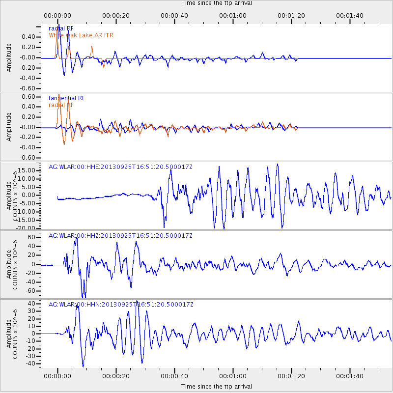
Signal To Noise
| Channel | StoN | STA | LTA |
| AG:WLAR:00:HHZ:20130925T16:51:20.500017Z | 56.40045 | 8.8527095E-6 | 1.5696169E-7 |
| AG:WLAR:00:HHN:20130925T16:51:20.500017Z | 3.6695447 | 4.0705577E-6 | 1.1092814E-6 |
| AG:WLAR:00:HHE:20130925T16:51:20.500017Z | 1.4781806 | 1.5527456E-6 | 1.0504438E-6 |
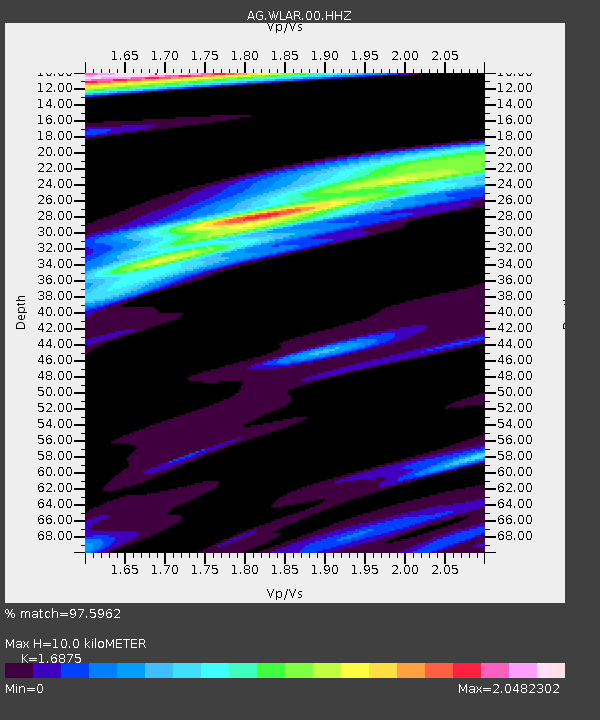
| Arrivals | |
| Ps | 1.2 SECOND |
| PpPs | 4.1 SECOND |
| PsPs/PpSs | 5.2 SECOND |

