You are here: Home > Network List > TA - USArray Transportable Network (new EarthScope stations) Stations List
> Station A21K Barrow, AK, USA > Earthquake Result Viewer
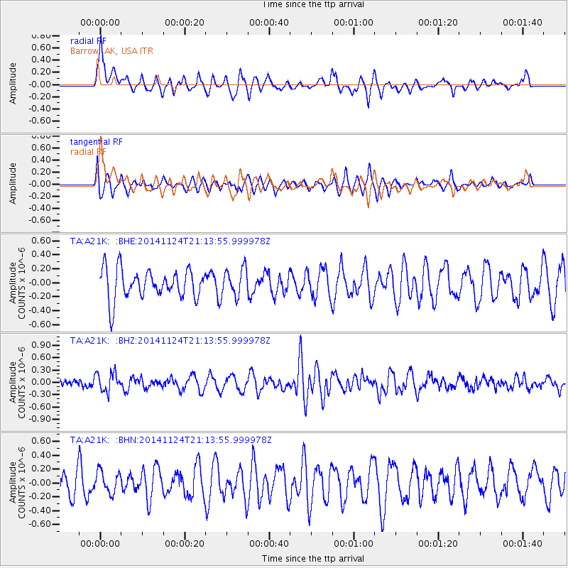
A21K Barrow, AK, USA - Earthquake Result Viewer
*The percent match for this event was below the threshold and hence no stack was calculated.
| Earthquake location: |
Solomon Islands |
| Earthquake latitude/longitude: |
-6.0/155.0 |
| Earthquake time(UTC): |
2014/11/24 (328) 21:02:19 GMT |
| Earthquake Depth: |
170 km |
| Earthquake Magnitude: |
5.6 MWW, 5.6 MWB, 5.7 MWC |
| Earthquake Catalog/Contributor: |
NEIC PDE/NEIC COMCAT |
|
| Network: |
TA USArray Transportable Network (new EarthScope stations) |
| Station: |
A21K Barrow, AK, USA |
| Lat/Lon: |
71.32 N/156.62 W |
| Elevation: |
577 m |
|
| Distance: |
83.4 deg |
| Az: |
14.041 deg |
| Baz: |
228.505 deg |
| Ray Param: |
$rayparam |
*The percent match for this event was below the threshold and hence was not used in the summary stack. |
|
| Radial Match: |
60.49988 % |
| Radial Bump: |
400 |
| Transverse Match: |
48.92078 % |
| Transverse Bump: |
400 |
| SOD ConfigId: |
3390531 |
| Insert Time: |
2019-04-15 04:42:48.265 +0000 |
| GWidth: |
2.5 |
| Max Bumps: |
400 |
| Tol: |
0.001 |
|
Signal To Noise
| Channel | StoN | STA | LTA |
| TA:A21K: :BHZ:20141124T21:13:55.999978Z | 1.7323049 | 2.2956154E-7 | 1.3251797E-7 |
| TA:A21K: :BHN:20141124T21:13:55.999978Z | 0.8090486 | 1.617594E-7 | 1.999378E-7 |
| TA:A21K: :BHE:20141124T21:13:55.999978Z | 0.93790454 | 1.9897657E-7 | 2.1215013E-7 |
| Arrivals |
| Ps | |
| PpPs | |
| PsPs/PpSs | |


