
KNW AZ.KNW - Earthquake Result Viewer
| ||||||||||||||||||
| ||||||||||||||||||
| ||||||||||||||||||
|
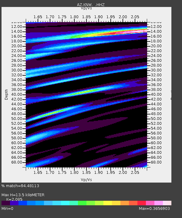
Signal To Noise
| Channel | StoN | STA | LTA |
| AZ:KNW: :HHZ:20130925T16:52:39.208025Z | 6.538232 | 2.3193354E-6 | 3.5473437E-7 |
| AZ:KNW: :HHN:20130925T16:52:39.208025Z | 2.3534548 | 1.702808E-6 | 7.235355E-7 |
| AZ:KNW: :HHE:20130925T16:52:39.208025Z | 3.3005652 | 6.600539E-7 | 1.9998208E-7 |
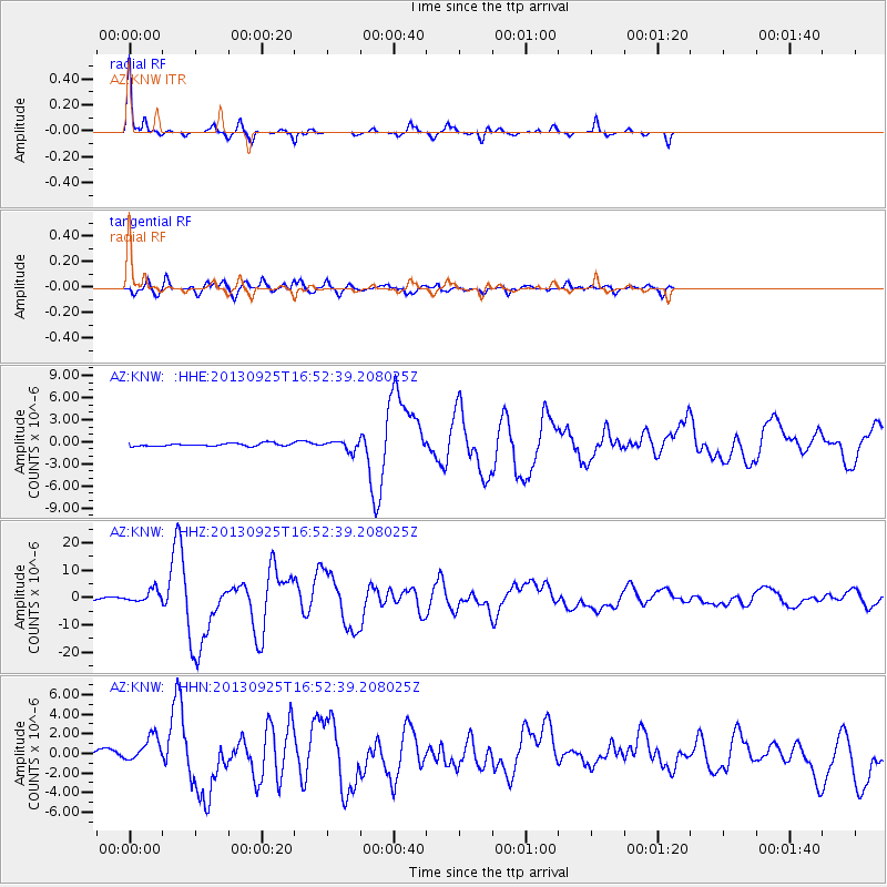
| Arrivals | |
| Ps | 2.4 SECOND |
| PpPs | 6.4 SECOND |
| PsPs/PpSs | 8.8 SECOND |

