LVA2 AZ.LVA2 - Earthquake Result Viewer
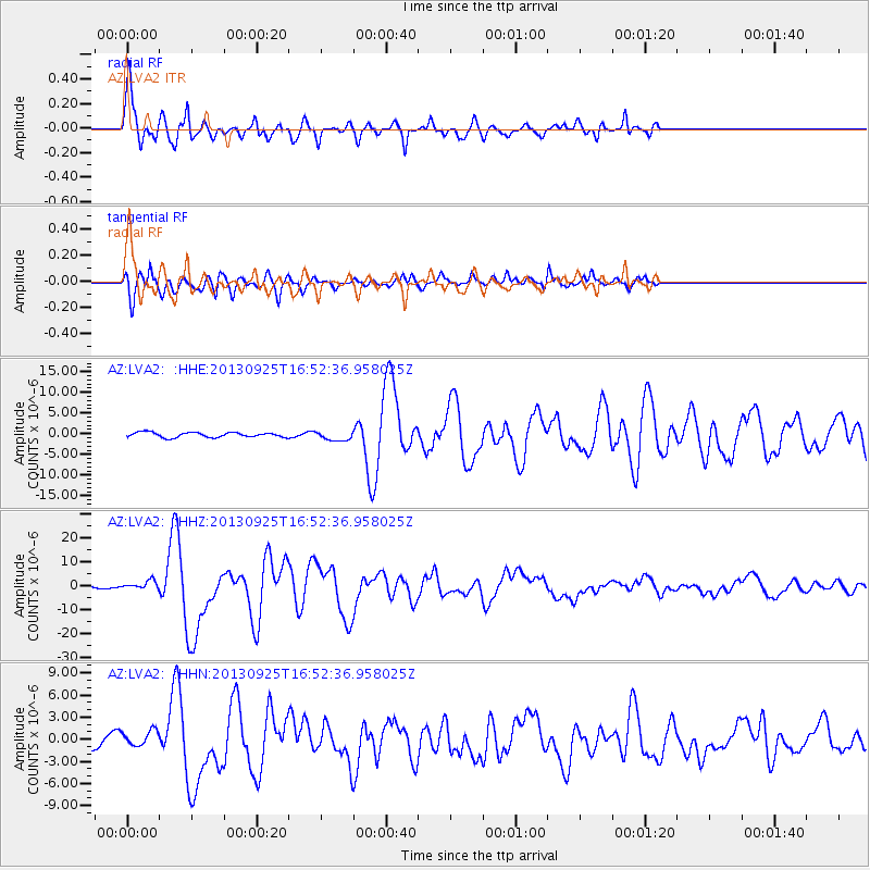
Earthquake location: Near Coast Of Peru
Earthquake latitude/longitude: -15.8/-74.5
Earthquake time(UTC): 2013/09/25 (268) 16:42:43 GMT
Earthquake Depth: 40 km
Earthquake Magnitude: 7.1 MWW, 6.8 MI, 7.0 MWB, 7.0 MWC, 7.1 MWW, 7.1 MWC
Earthquake Catalog/Contributor: NEIC PDE/NEIC COMCAT
Network: AZ ANZA Regional Network
Station: LVA2 AZ.LVA2
Lat/Lon: 33.35 N/116.56 W
Elevation: 1435 m
Distance: 63.3 deg
Az: 321.12 deg
Baz: 133.795 deg
Ray Param: 0.05961175
Estimated Moho Depth: 48.0 km
Estimated Crust Vp/Vs: 1.72
Assumed Crust Vp: 6.264 km/s
Estimated Crust Vs: 3.647 km/s
Estimated Crust Poisson's Ratio: 0.24
Radial Match: 93.33114 %
Radial Bump: 400
Transverse Match: 86.23137 %
Transverse Bump: 400
SOD ConfigId: 626651
Insert Time: 2014-04-18 20:09:37.142 +0000
GWidth: 2.5
Max Bumps: 400
Tol: 0.001

Signal To Noise

ChannelStoNSTALTA
AZ:LVA2: :HHZ:20130925T16:52:36.958025Z3.7693021.8648823E-64.9475534E-7
AZ:LVA2: :HHN:20130925T16:52:36.958025Z1.28147221.0954151E-68.548098E-7
AZ:LVA2: :HHE:20130925T16:52:36.958025Z1.94517211.150499E-65.914639E-7
Arrivals
Ps5.7 SECOND
PpPs20 SECOND
PsPs/PpSs26 SECOND