
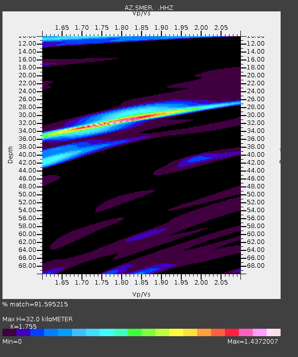
SMER AZ.SMER - Earthquake Result Viewer
| ||||||||||||||||||
| ||||||||||||||||||
| ||||||||||||||||||
|
Signal To Noise
| Channel | StoN | STA | LTA |
| AZ:SMER: :HHZ:20130925T16:52:39.878008Z | 5.8061447 | 1.7832906E-6 | 3.071385E-7 |
| AZ:SMER: :HHN:20130925T16:52:39.878008Z | 1.9795133 | 7.8505906E-7 | 3.9659196E-7 |
| AZ:SMER: :HHE:20130925T16:52:39.878008Z | 2.6345663 | 7.3571744E-7 | 2.792556E-7 |
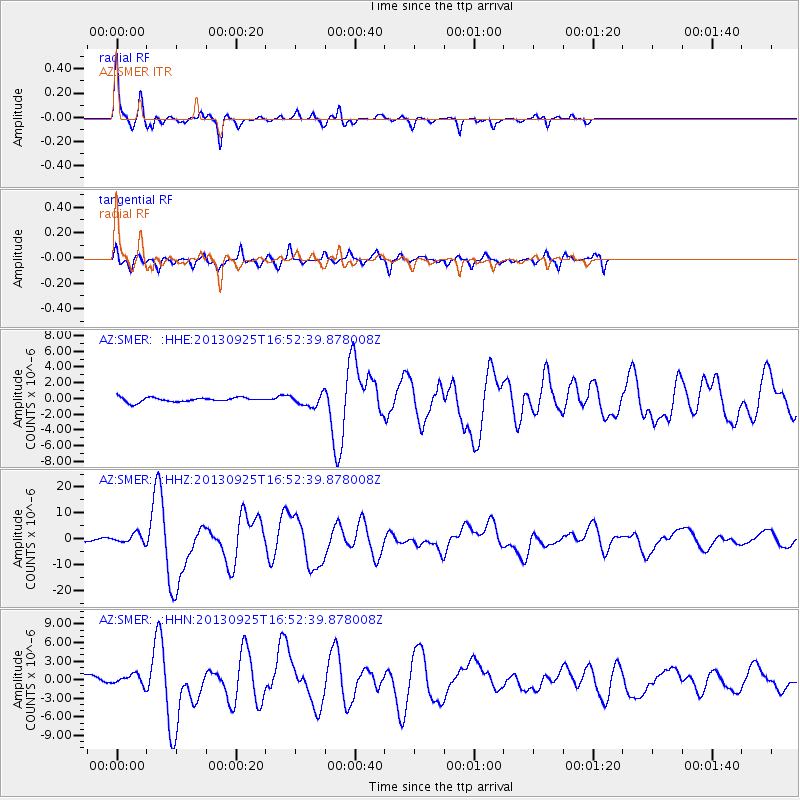
| Arrivals | |
| Ps | 4.0 SECOND |
| PpPs | 14 SECOND |
| PsPs/PpSs | 18 SECOND |

