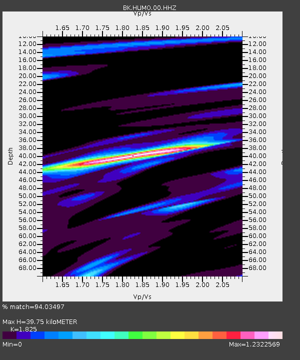
HUMO Hull Mountain, OR - Earthquake Result Viewer

Earthquake location: Near Coast Of Peru
Earthquake latitude/longitude: -15.8/-74.5
Earthquake time(UTC): 2013/09/25 (268) 16:42:43 GMT
Earthquake Depth: 40 km
Earthquake Magnitude: 7.1 MWW, 6.8 MI, 7.0 MWB, 7.0 MWC, 7.1 MWW, 7.1 MWC
Earthquake Catalog/Contributor: NEIC PDE/NEIC COMCAT
Network: BK Berkeley Digital Seismograph Network
Station: HUMO Hull Mountain, OR
Lat/Lon: 42.61 N/122.96 W
Elevation: 555 m
Distance: 73.2 deg
Az: 324.761 deg
Baz: 131.215 deg
Ray Param: 0.05307076
Estimated Moho Depth: 39.75 km
Estimated Crust Vp/Vs: 1.83
Assumed Crust Vp: 6.522 km/s
Estimated Crust Vs: 3.573 km/s
Estimated Crust Poisson's Ratio: 0.29
Radial Match: 94.03497 %
Radial Bump: 315
Transverse Match: 82.41838 %
Transverse Bump: 400
SOD ConfigId: 626651
Insert Time: 2014-04-18 20:10:17.258 +0000
GWidth: 2.5
Max Bumps: 400
Tol: 0.001

Signal To Noise

ChannelStoNSTALTA
BK:HUMO:00:HHZ:20130925T16:53:39.198015Z2.98193981.3270205E-64.4501923E-7
BK:HUMO:00:HHN:20130925T16:53:39.198015Z0.906281953.1075805E-73.4289334E-7
BK:HUMO:00:HHE:20130925T16:53:39.198015Z1.22038836.540876E-75.359668E-7
Arrivals
Ps5.2 SECOND
PpPs17 SECOND
PsPs/PpSs22 SECOND