SENIN Lac Selin/Sanetsch - Earthquake Result Viewer
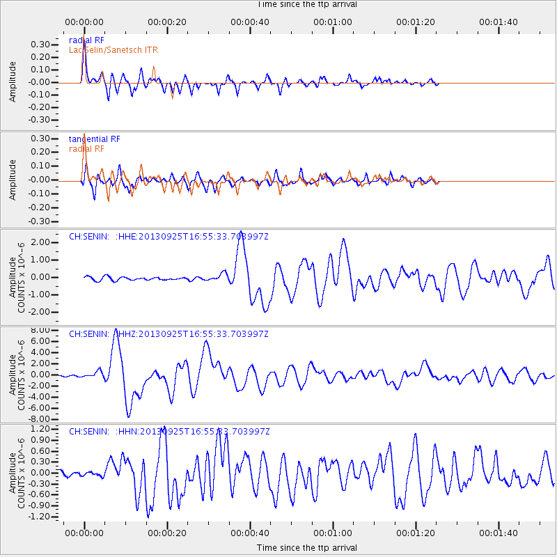
Earthquake location: Near Coast Of Peru
Earthquake latitude/longitude: -15.8/-74.5
Earthquake time(UTC): 2013/09/25 (268) 16:42:43 GMT
Earthquake Depth: 40 km
Earthquake Magnitude: 7.1 MWW, 6.8 MI, 7.0 MWB, 7.0 MWC, 7.1 MWW, 7.1 MWC
Earthquake Catalog/Contributor: NEIC PDE/NEIC COMCAT
Network: CH Switzerland Seismological Network
Station: SENIN Lac Selin/Sanetsch
Lat/Lon: 46.36 N/7.30 E
Elevation: 2035 m
Distance: 95.8 deg
Az: 43.547 deg
Baz: 253.249 deg
Ray Param: 0.04067137
Estimated Moho Depth: 23.5 km
Estimated Crust Vp/Vs: 1.60
Assumed Crust Vp: 6.276 km/s
Estimated Crust Vs: 3.922 km/s
Estimated Crust Poisson's Ratio: 0.18
Radial Match: 93.6827 %
Radial Bump: 400
Transverse Match: 85.19299 %
Transverse Bump: 400
SOD ConfigId: 626651
Insert Time: 2014-04-18 20:11:22.795 +0000
GWidth: 2.5
Max Bumps: 400
Tol: 0.001

Signal To Noise

ChannelStoNSTALTA
CH:SENIN: :HHZ:20130925T16:55:33.703997Z9.3305936.233801E-76.6810344E-8
CH:SENIN: :HHN:20130925T16:55:33.703997Z0.62015265.196499E-88.379388E-8
CH:SENIN: :HHE:20130925T16:55:33.703997Z2.27393412.2313165E-79.8125824E-8
Arrivals
Ps2.3 SECOND
PpPs9.5 SECOND
PsPs/PpSs12 SECOND