FRB IQALUIT, N.W.T. - Earthquake Result Viewer
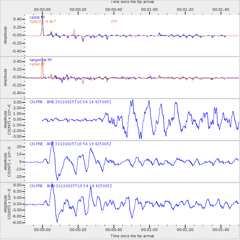
Earthquake location: Near Coast Of Peru
Earthquake latitude/longitude: -15.8/-74.5
Earthquake time(UTC): 2013/09/25 (268) 16:42:43 GMT
Earthquake Depth: 40 km
Earthquake Magnitude: 7.1 MWW, 6.8 MI, 7.0 MWB, 7.0 MWC, 7.1 MWW, 7.1 MWC
Earthquake Catalog/Contributor: NEIC PDE/NEIC COMCAT
Network: CN Canadian National Seismograph Network
Station: FRB IQALUIT, N.W.T.
Lat/Lon: 63.75 N/68.55 W
Elevation: 18 m
Distance: 79.5 deg
Az: 2.694 deg
Baz: 185.839 deg
Ray Param: 0.048878334
Estimated Moho Depth: 42.75 km
Estimated Crust Vp/Vs: 1.75
Assumed Crust Vp: 6.419 km/s
Estimated Crust Vs: 3.673 km/s
Estimated Crust Poisson's Ratio: 0.26
Radial Match: 97.82824 %
Radial Bump: 201
Transverse Match: 96.192825 %
Transverse Bump: 400
SOD ConfigId: 626651
Insert Time: 2014-04-18 20:13:23.749 +0000
GWidth: 2.5
Max Bumps: 400
Tol: 0.001

Signal To Noise

ChannelStoNSTALTA
CN:FRB: :BHZ:20130925T16:54:14.425005Z23.1949335.0452622E-62.1751569E-7
CN:FRB: :BHN:20130925T16:54:14.425005Z11.7330041.8743349E-61.5974894E-7
CN:FRB: :BHE:20130925T16:54:14.425005Z1.45239851.998632E-71.3760905E-7
Arrivals
Ps5.1 SECOND
PpPs18 SECOND
PsPs/PpSs23 SECOND