SADO SADOWA, ON - Earthquake Result Viewer
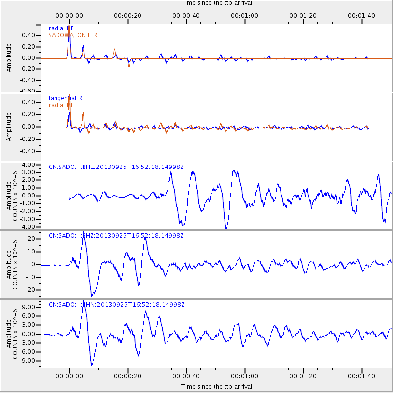
Earthquake location: Near Coast Of Peru
Earthquake latitude/longitude: -15.8/-74.5
Earthquake time(UTC): 2013/09/25 (268) 16:42:43 GMT
Earthquake Depth: 40 km
Earthquake Magnitude: 7.1 MWW, 6.8 MI, 7.0 MWB, 7.0 MWC, 7.1 MWW, 7.1 MWC
Earthquake Catalog/Contributor: NEIC PDE/NEIC COMCAT
Network: CN Canadian National Seismograph Network
Station: SADO SADOWA, ON
Lat/Lon: 44.77 N/79.14 W
Elevation: 243 m
Distance: 60.5 deg
Az: 356.21 deg
Baz: 174.876 deg
Ray Param: 0.061437313
Estimated Moho Depth: 40.25 km
Estimated Crust Vp/Vs: 1.74
Assumed Crust Vp: 6.577 km/s
Estimated Crust Vs: 3.791 km/s
Estimated Crust Poisson's Ratio: 0.25
Radial Match: 97.209 %
Radial Bump: 177
Transverse Match: 93.15152 %
Transverse Bump: 301
SOD ConfigId: 626651
Insert Time: 2014-04-18 20:14:05.803 +0000
GWidth: 2.5
Max Bumps: 400
Tol: 0.001

Signal To Noise

ChannelStoNSTALTA
CN:SADO: :BHZ:20130925T16:52:18.14998Z37.9015358.41924E-62.2213453E-7
CN:SADO: :BHN:20130925T16:52:18.14998Z14.3523.702881E-62.5800452E-7
CN:SADO: :BHE:20130925T16:52:18.14998Z4.34301951.061812E-62.44487E-7
Arrivals
Ps4.7 SECOND
PpPs16 SECOND
PsPs/PpSs21 SECOND