ULM LAC DU BONNET, MB - Earthquake Result Viewer
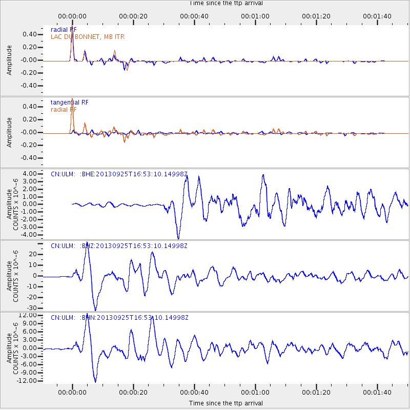
Earthquake location: Near Coast Of Peru
Earthquake latitude/longitude: -15.8/-74.5
Earthquake time(UTC): 2013/09/25 (268) 16:42:43 GMT
Earthquake Depth: 40 km
Earthquake Magnitude: 7.1 MWW, 6.8 MI, 7.0 MWB, 7.0 MWC, 7.1 MWW, 7.1 MWC
Earthquake Catalog/Contributor: NEIC PDE/NEIC COMCAT
Network: CN Canadian National Seismograph Network
Station: ULM LAC DU BONNET, MB
Lat/Lon: 50.25 N/95.88 W
Elevation: 251 m
Distance: 68.4 deg
Az: 345.436 deg
Baz: 157.851 deg
Ray Param: 0.056232404
Estimated Moho Depth: 30.25 km
Estimated Crust Vp/Vs: 1.87
Assumed Crust Vp: 6.459 km/s
Estimated Crust Vs: 3.454 km/s
Estimated Crust Poisson's Ratio: 0.30
Radial Match: 97.98161 %
Radial Bump: 201
Transverse Match: 91.68558 %
Transverse Bump: 400
SOD ConfigId: 626651
Insert Time: 2014-04-18 20:14:16.020 +0000
GWidth: 2.5
Max Bumps: 400
Tol: 0.001

Signal To Noise

ChannelStoNSTALTA
CN:ULM: :BHZ:20130925T16:53:10.14998Z60.3162351.0495458E-51.7400717E-7
CN:ULM: :BHN:20130925T16:53:10.14998Z25.6019884.098294E-61.6007719E-7
CN:ULM: :BHE:20130925T16:53:10.14998Z9.9153741.5506117E-61.563846E-7
Arrivals
Ps4.2 SECOND
PpPs13 SECOND
PsPs/PpSs17 SECOND