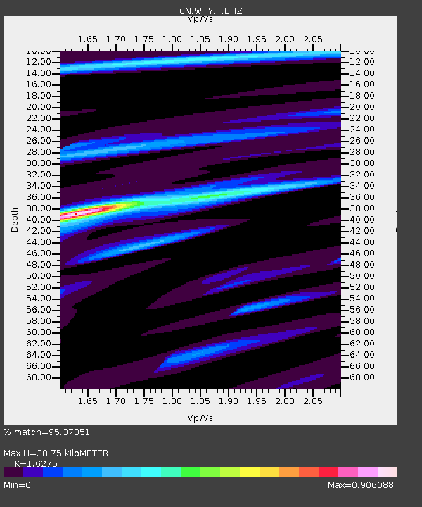
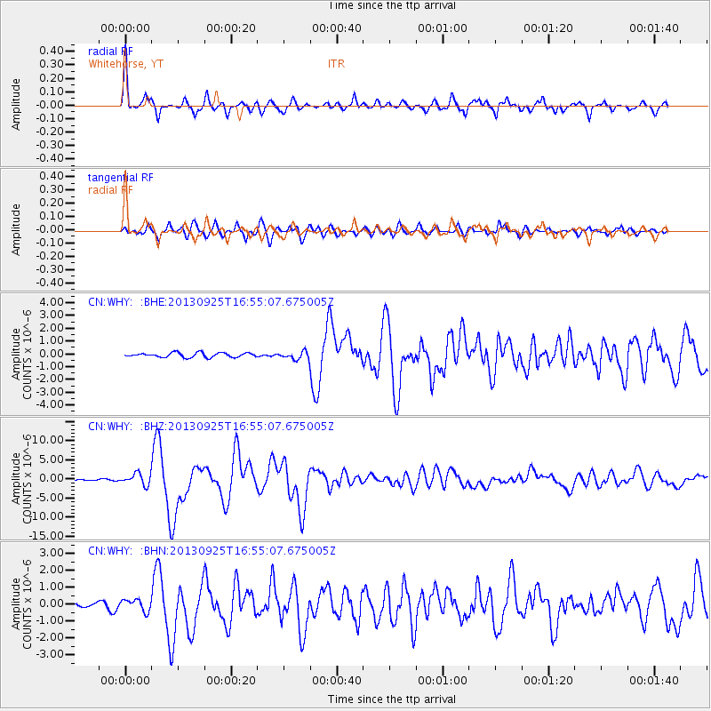
WHY Whitehorse, YT - Earthquake Result Viewer

Earthquake location: Near Coast Of Peru
Earthquake latitude/longitude: -15.8/-74.5
Earthquake time(UTC): 2013/09/25 (268) 16:42:43 GMT
Earthquake Depth: 40 km
Earthquake Magnitude: 7.1 MWW, 6.8 MI, 7.0 MWB, 7.0 MWC, 7.1 MWW, 7.1 MWC
Earthquake Catalog/Contributor: NEIC PDE/NEIC COMCAT
Network: CN Canadian National Seismograph Network
Station: WHY Whitehorse, YT
Lat/Lon: 60.66 N/134.88 W
Elevation: 1292 m
Distance: 90.1 deg
Az: 334.653 deg
Baz: 123.212 deg
Ray Param: 0.041692205
Estimated Moho Depth: 38.75 km
Estimated Crust Vp/Vs: 1.63
Assumed Crust Vp: 6.419 km/s
Estimated Crust Vs: 3.944 km/s
Estimated Crust Poisson's Ratio: 0.20
Radial Match: 95.37051 %
Radial Bump: 338
Transverse Match: 90.51345 %
Transverse Bump: 400
SOD ConfigId: 626651
Insert Time: 2014-04-18 20:14:26.389 +0000
GWidth: 2.5
Max Bumps: 400
Tol: 0.001

Signal To Noise

ChannelStoNSTALTA
CN:WHY: :BHZ:20130925T16:55:07.675005Z14.2756171.5018652E-61.05204926E-7
CN:WHY: :BHN:20130925T16:55:07.675005Z2.6384023.468059E-71.3144545E-7
CN:WHY: :BHE:20130925T16:55:07.675005Z1.68437342.9379402E-71.7442333E-7
Arrivals
Ps3.9 SECOND
PpPs16 SECOND
PsPs/PpSs19 SECOND