
CLF Chambon la Foret observatory, France - Earthquake Result Viewer
| ||||||||||||||||||
| ||||||||||||||||||
| ||||||||||||||||||
|
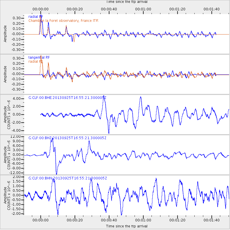
Signal To Noise
| Channel | StoN | STA | LTA |
| G:CLF:00:BHZ:20130925T16:55:21.300005Z | 5.5957685 | 9.590674E-7 | 1.7139155E-7 |
| G:CLF:00:BHN:20130925T16:55:21.300005Z | 0.8206259 | 2.9009792E-7 | 3.535081E-7 |
| G:CLF:00:BHE:20130925T16:55:21.300005Z | 2.3362303 | 5.3551094E-7 | 2.2922012E-7 |
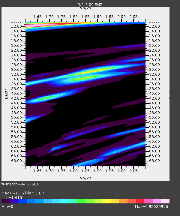
| Arrivals | |
| Ps | 1.2 SECOND |
| PpPs | 4.8 SECOND |
| PsPs/PpSs | 6.0 SECOND |

