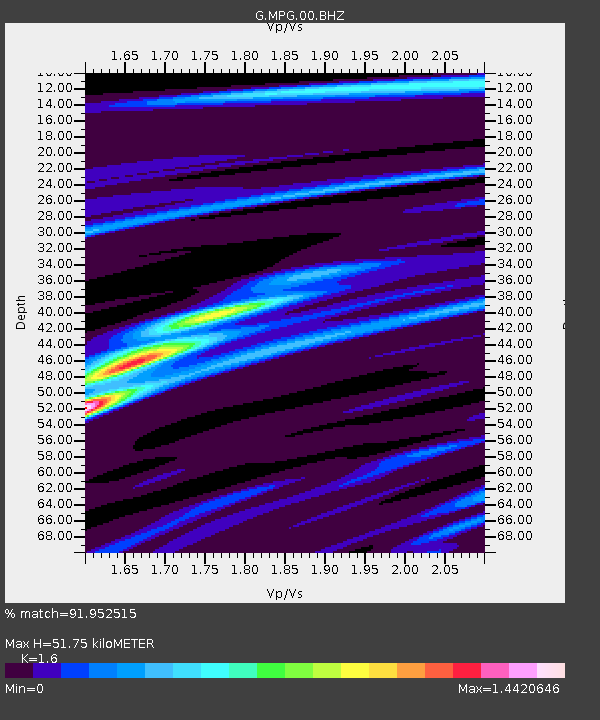
MPG Montagne des Peres, French Guyana - Earthquake Result Viewer
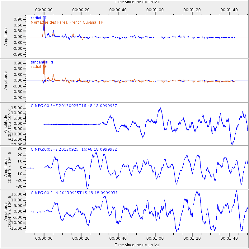
Earthquake location: Near Coast Of Peru
Earthquake latitude/longitude: -15.8/-74.5
Earthquake time(UTC): 2013/09/25 (268) 16:42:43 GMT
Earthquake Depth: 40 km
Earthquake Magnitude: 7.1 MWW, 6.8 MI, 7.0 MWB, 7.0 MWC, 7.1 MWW, 7.1 MWC
Earthquake Catalog/Contributor: NEIC PDE/NEIC COMCAT
Network: G GEOSCOPE
Station: MPG Montagne des Peres, French Guyana
Lat/Lon: 5.11 N/52.64 W
Elevation: 147 m
Distance: 30.0 deg
Az: 47.843 deg
Baz: 225.752 deg
Ray Param: 0.07939527
Estimated Moho Depth: 51.75 km
Estimated Crust Vp/Vs: 1.60
Assumed Crust Vp: 6.472 km/s
Estimated Crust Vs: 4.045 km/s
Estimated Crust Poisson's Ratio: 0.18
Radial Match: 91.952515 %
Radial Bump: 277
Transverse Match: 55.081154 %
Transverse Bump: 400
SOD ConfigId: 626651
Insert Time: 2014-04-18 20:15:56.417 +0000
GWidth: 2.5
Max Bumps: 400
Tol: 0.001

Signal To Noise

ChannelStoNSTALTA
G:MPG:00:BHZ:20130925T16:48:18.099993Z28.2356473.063601E-61.08501176E-7
G:MPG:00:BHN:20130925T16:48:18.099993Z19.1722761.3606565E-67.097E-8
G:MPG:00:BHE:20130925T16:48:18.099993Z11.9586371.4550352E-61.2167233E-7
Arrivals
Ps5.3 SECOND
PpPs19 SECOND
PsPs/PpSs24 SECOND