You are here: Home > Network List > CI - Caltech Regional Seismic Network Stations List
> Station TIN Tinemaha, California, USA > Earthquake Result Viewer
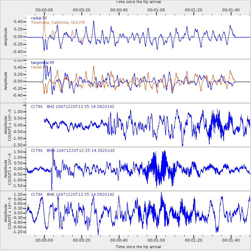
TIN Tinemaha, California, USA - Earthquake Result Viewer
*The percent match for this event was below the threshold and hence no stack was calculated.
| Earthquake location: |
Sea Of Okhotsk |
| Earthquake latitude/longitude: |
53.4/152.8 |
| Earthquake time(UTC): |
1997/12/20 (354) 13:26:31 GMT |
| Earthquake Depth: |
614 km |
| Earthquake Magnitude: |
5.9 UNKNOWN, 5.1 MB, 5.9 MW |
| Earthquake Catalog/Contributor: |
WHDF/NEIC |
|
| Network: |
CI Caltech Regional Seismic Network |
| Station: |
TIN Tinemaha, California, USA |
| Lat/Lon: |
37.05 N/118.23 W |
| Elevation: |
1164 m |
|
| Distance: |
60.7 deg |
| Az: |
66.489 deg |
| Baz: |
316.687 deg |
| Ray Param: |
$rayparam |
*The percent match for this event was below the threshold and hence was not used in the summary stack. |
|
| Radial Match: |
47.57383 % |
| Radial Bump: |
400 |
| Transverse Match: |
56.615555 % |
| Transverse Bump: |
400 |
| SOD ConfigId: |
4480 |
| Insert Time: |
2010-02-25 20:52:21.313 +0000 |
| GWidth: |
2.5 |
| Max Bumps: |
400 |
| Tol: |
0.001 |
|
Signal To Noise
| Channel | StoN | STA | LTA |
| CI:TIN: :BHN:19971220T13:35:14.382019Z | 3.5803804 | 5.9472E-7 | 1.6610527E-7 |
| CI:TIN: :BHE:19971220T13:35:14.382019Z | 2.1590357 | 6.317273E-7 | 2.9259695E-7 |
| CI:TIN: :BHZ:19971220T13:35:14.382019Z | 1.2076516 | 2.4623068E-7 | 2.0389216E-7 |
| Arrivals |
| Ps | |
| PpPs | |
| PsPs/PpSs | |


