You are here: Home > Network List > II - Global Seismograph Network (GSN - IRIS/IDA) Stations List
> Station ARU Arti, Russia > Earthquake Result Viewer
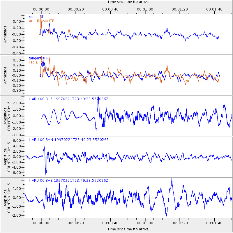
ARU Arti, Russia - Earthquake Result Viewer
*The percent match for this event was below the threshold and hence no stack was calculated.
| Earthquake location: |
East Of Kuril Islands |
| Earthquake latitude/longitude: |
43.8/149.2 |
| Earthquake time(UTC): |
1997/02/21 (052) 23:40:24 GMT |
| Earthquake Depth: |
33 km |
| Earthquake Magnitude: |
6.1 MB, 5.6 MS, 6.1 UNKNOWN, 6.1 MW |
| Earthquake Catalog/Contributor: |
WHDF/NEIC |
|
| Network: |
II Global Seismograph Network (GSN - IRIS/IDA) |
| Station: |
ARU Arti, Russia |
| Lat/Lon: |
56.43 N/58.56 E |
| Elevation: |
250 m |
|
| Distance: |
55.3 deg |
| Az: |
317.481 deg |
| Baz: |
61.697 deg |
| Ray Param: |
$rayparam |
*The percent match for this event was below the threshold and hence was not used in the summary stack. |
|
| Radial Match: |
57.219353 % |
| Radial Bump: |
400 |
| Transverse Match: |
69.629654 % |
| Transverse Bump: |
400 |
| SOD ConfigId: |
4480 |
| Insert Time: |
2010-03-01 16:57:17.288 +0000 |
| GWidth: |
2.5 |
| Max Bumps: |
400 |
| Tol: |
0.001 |
|
Signal To Noise
| Channel | StoN | STA | LTA |
| II:ARU:00:BHN:19970221T23:49:23.552026Z | 3.0182471 | 2.6622472E-6 | 8.820508E-7 |
| II:ARU:00:BHE:19970221T23:49:23.552026Z | 1.5338355 | 5.470601E-7 | 3.566615E-7 |
| II:ARU:00:BHZ:19970221T23:49:23.552026Z | 1.9991926 | 1.227854E-6 | 6.1417495E-7 |
| Arrivals |
| Ps | |
| PpPs | |
| PsPs/PpSs | |


