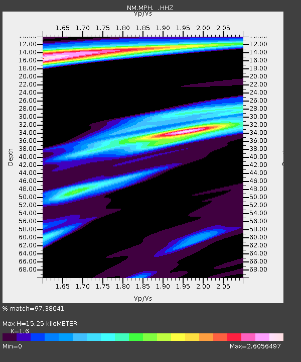
MPH Memphis, TN - Earthquake Result Viewer

Earthquake location: Near Coast Of Peru
Earthquake latitude/longitude: -15.8/-74.5
Earthquake time(UTC): 2013/09/25 (268) 16:42:43 GMT
Earthquake Depth: 40 km
Earthquake Magnitude: 7.1 MWW, 6.8 MI, 7.0 MWB, 7.0 MWC, 7.1 MWW, 7.1 MWC
Earthquake Catalog/Contributor: NEIC PDE/NEIC COMCAT
Network: NM Cooperative New Madrid Seismic Network
Station: MPH Memphis, TN
Lat/Lon: 35.12 N/89.93 W
Elevation: 93 m
Distance: 52.8 deg
Az: 344.108 deg
Baz: 161.245 deg
Ray Param: 0.06647071
Estimated Moho Depth: 15.25 km
Estimated Crust Vp/Vs: 1.60
Assumed Crust Vp: 6.38 km/s
Estimated Crust Vs: 3.988 km/s
Estimated Crust Poisson's Ratio: 0.18
Radial Match: 97.38041 %
Radial Bump: 332
Transverse Match: 85.56482 %
Transverse Bump: 400
SOD ConfigId: 626651
Insert Time: 2014-04-18 20:23:23.590 +0000
GWidth: 2.5
Max Bumps: 400
Tol: 0.001

Signal To Noise

ChannelStoNSTALTA
NM:MPH: :HHZ:20130925T16:51:23.487993Z16.606131.1163873E-56.7227415E-7
NM:MPH: :HHN:20130925T16:51:23.487993Z4.48381475.268892E-61.1750914E-6
NM:MPH: :HHE:20130925T16:51:23.487993Z1.90458121.756757E-69.2238497E-7
Arrivals
Ps1.5 SECOND
PpPs5.9 SECOND
PsPs/PpSs7.4 SECOND