UTMT Martin, TN - Earthquake Result Viewer
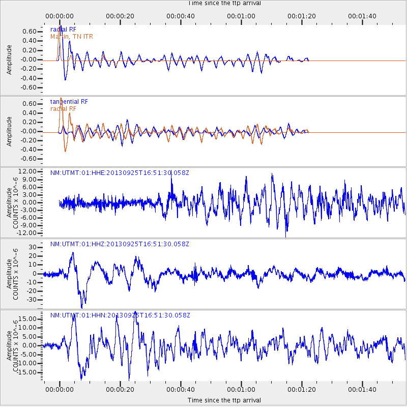
Earthquake location: Near Coast Of Peru
Earthquake latitude/longitude: -15.8/-74.5
Earthquake time(UTC): 2013/09/25 (268) 16:42:43 GMT
Earthquake Depth: 40 km
Earthquake Magnitude: 7.1 MWW, 6.8 MI, 7.0 MWB, 7.0 MWC, 7.1 MWW, 7.1 MWC
Earthquake Catalog/Contributor: NEIC PDE/NEIC COMCAT
Network: NM Cooperative New Madrid Seismic Network
Station: UTMT Martin, TN
Lat/Lon: 36.35 N/88.86 W
Elevation: 110 m
Distance: 53.6 deg
Az: 345.613 deg
Baz: 162.768 deg
Ray Param: 0.0658711
Estimated Moho Depth: 10.75 km
Estimated Crust Vp/Vs: 1.60
Assumed Crust Vp: 6.444 km/s
Estimated Crust Vs: 4.021 km/s
Estimated Crust Poisson's Ratio: 0.18
Radial Match: 91.379074 %
Radial Bump: 400
Transverse Match: 78.331665 %
Transverse Bump: 400
SOD ConfigId: 626651
Insert Time: 2014-04-18 20:24:00.070 +0000
GWidth: 2.5
Max Bumps: 400
Tol: 0.001

Signal To Noise

ChannelStoNSTALTA
NM:UTMT:01:HHZ:20130925T16:51:30.058Z6.1242351.0490555E-51.7129576E-6
NM:UTMT:01:HHN:20130925T16:51:30.058Z5.73796226.198901E-61.0803313E-6
NM:UTMT:01:HHE:20130925T16:51:30.058Z1.68078392.0171096E-61.2001005E-6
Arrivals
Ps1.1 SECOND
PpPs4.1 SECOND
PsPs/PpSs5.2 SECOND