
PAGS PA Geological Survey - Earthquake Result Viewer
| ||||||||||||||||||
| ||||||||||||||||||
| ||||||||||||||||||
|
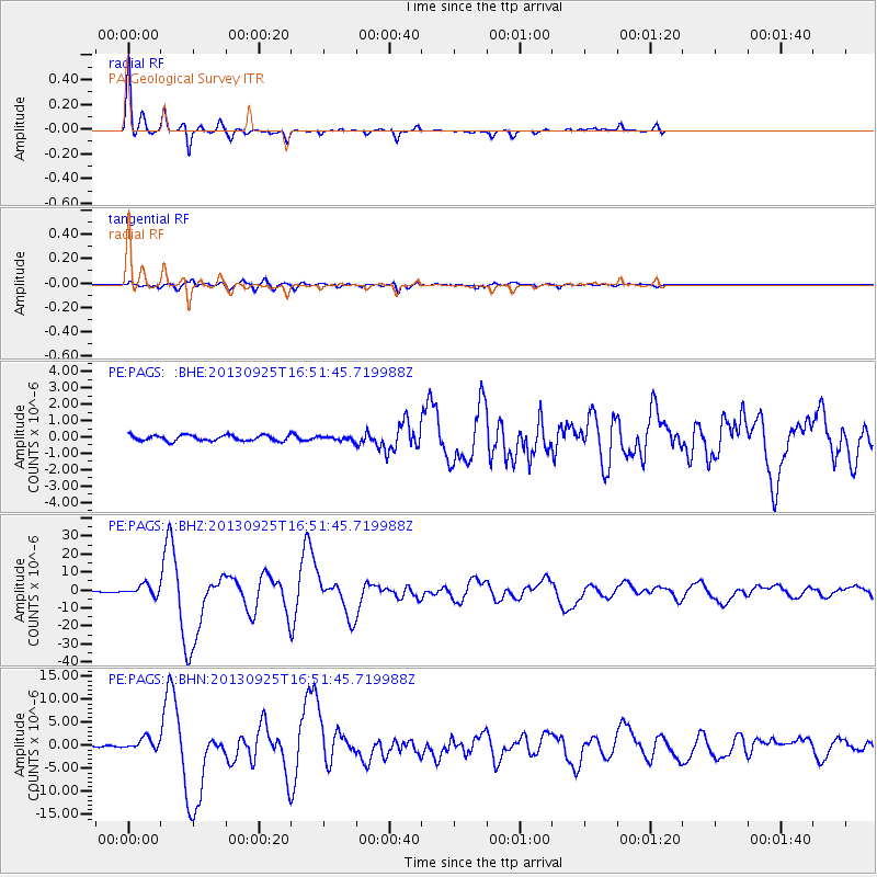
Signal To Noise
| Channel | StoN | STA | LTA |
| PE:PAGS: :BHZ:20130925T16:51:45.719988Z | 10.427008 | 2.9774733E-6 | 2.8555397E-7 |
| PE:PAGS: :BHN:20130925T16:51:45.719988Z | 6.2337465 | 1.2943923E-6 | 2.0764276E-7 |
| PE:PAGS: :BHE:20130925T16:51:45.719988Z | 0.6717229 | 1.1717641E-7 | 1.744416E-7 |
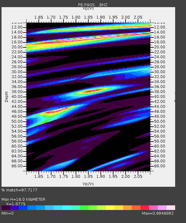
| Arrivals | |
| Ps | 2.4 SECOND |
| PpPs | 7.2 SECOND |
| PsPs/PpSs | 9.6 SECOND |

