WRPS We R Penn State - Earthquake Result Viewer
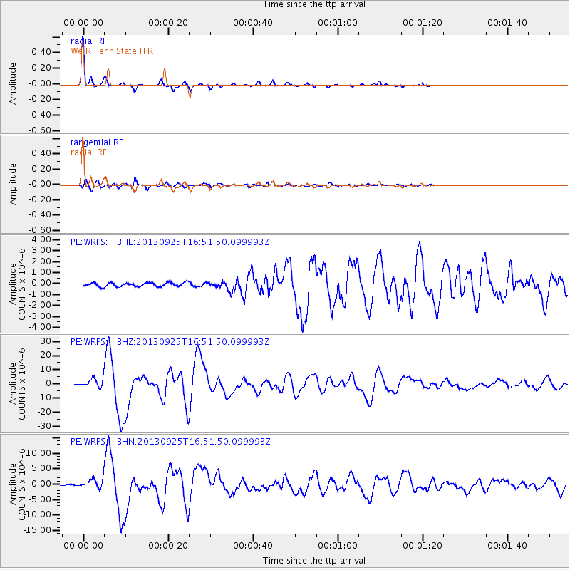
Earthquake location: Near Coast Of Peru
Earthquake latitude/longitude: -15.8/-74.5
Earthquake time(UTC): 2013/09/25 (268) 16:42:43 GMT
Earthquake Depth: 40 km
Earthquake Magnitude: 7.1 MWW, 6.8 MI, 7.0 MWB, 7.0 MWC, 7.1 MWW, 7.1 MWC
Earthquake Catalog/Contributor: NEIC PDE/NEIC COMCAT
Network: PE Penn State Network
Station: WRPS We R Penn State
Lat/Lon: 40.79 N/77.87 W
Elevation: 320 m
Distance: 56.4 deg
Az: 356.944 deg
Baz: 176.125 deg
Ray Param: 0.064066656
Estimated Moho Depth: 35.5 km
Estimated Crust Vp/Vs: 1.89
Assumed Crust Vp: 6.121 km/s
Estimated Crust Vs: 3.23 km/s
Estimated Crust Poisson's Ratio: 0.31
Radial Match: 97.21471 %
Radial Bump: 161
Transverse Match: 90.77142 %
Transverse Bump: 400
SOD ConfigId: 626651
Insert Time: 2014-04-18 20:25:59.937 +0000
GWidth: 2.5
Max Bumps: 400
Tol: 0.001

Signal To Noise

ChannelStoNSTALTA
PE:WRPS: :BHZ:20130925T16:51:50.099993Z15.3072223.1517366E-62.0589866E-7
PE:WRPS: :BHN:20130925T16:51:50.099993Z11.8933931.5527145E-61.305527E-7
PE:WRPS: :BHE:20130925T16:51:50.099993Z1.89038633.192065E-71.688578E-7
Arrivals
Ps5.4 SECOND
PpPs16 SECOND
PsPs/PpSs22 SECOND