CIL Cilaos (Pompiers) - Earthquake Result Viewer
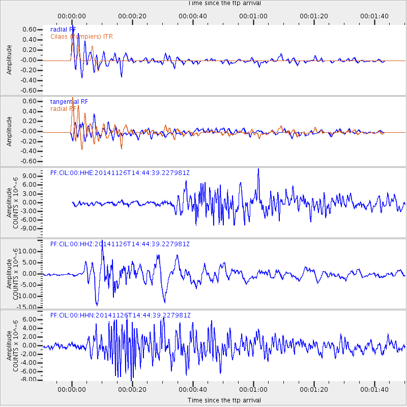
Earthquake location: Northern Molucca Sea
Earthquake latitude/longitude: 1.9/126.5
Earthquake time(UTC): 2014/11/26 (330) 14:33:43 GMT
Earthquake Depth: 39 km
Earthquake Magnitude: 6.8 MWW, 6.8 MWC, 6.8 MWB, 7.0 MI
Earthquake Catalog/Contributor: NEIC PDE/NEIC COMCAT
Network: PF Volcanologic Network of Piton de Fournaise-OVPF
Station: CIL Cilaos (Pompiers)
Lat/Lon: 21.13 S/55.47 E
Elevation: 1223 m
Distance: 73.1 deg
Az: 247.357 deg
Baz: 81.138 deg
Ray Param: 0.05316992
Estimated Moho Depth: 10.0 km
Estimated Crust Vp/Vs: 1.74
Assumed Crust Vp: 4.73 km/s
Estimated Crust Vs: 2.718 km/s
Estimated Crust Poisson's Ratio: 0.25
Radial Match: 89.58868 %
Radial Bump: 400
Transverse Match: 81.725426 %
Transverse Bump: 400
SOD ConfigId: 3390531
Insert Time: 2019-04-15 04:59:23.875 +0000
GWidth: 2.5
Max Bumps: 400
Tol: 0.001

Signal To Noise

ChannelStoNSTALTA
PF:CIL:00:HHZ:20141126T14:44:39.227981Z4.47922471.9068943E-64.2571972E-7
PF:CIL:00:HHN:20141126T14:44:39.227981Z0.805901474.1322622E-75.1275026E-7
PF:CIL:00:HHE:20141126T14:44:39.227981Z2.5262151.1627506E-64.6027378E-7
Arrivals
Ps1.6 SECOND
PpPs5.7 SECOND
PsPs/PpSs7.3 SECOND