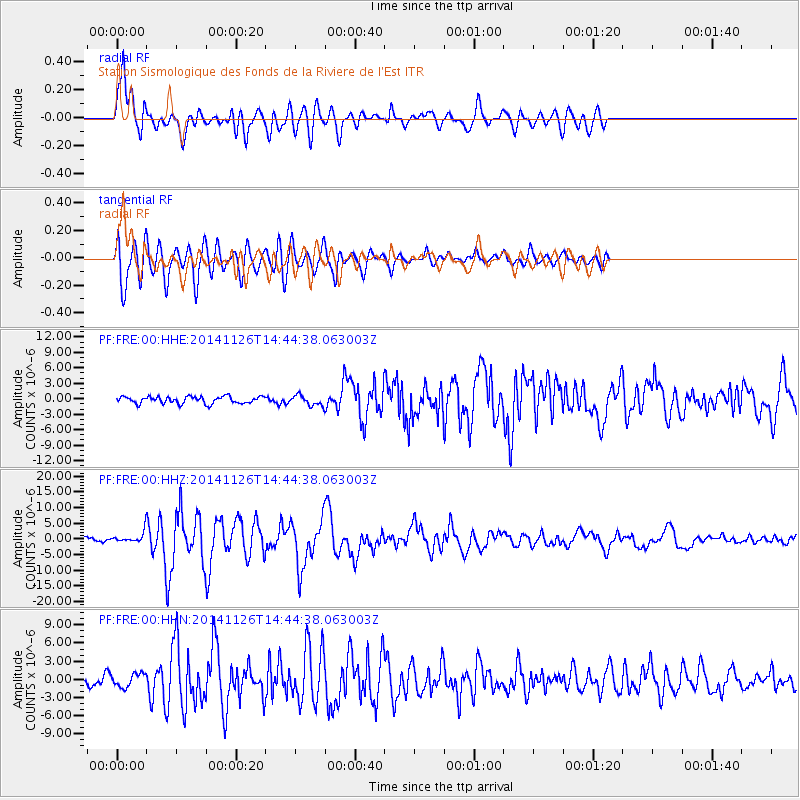
FRE Station Sismologique des Fonds de la Riviere de l'Est - Earthquake Result Viewer
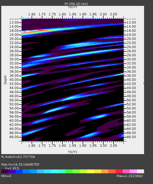
Earthquake location: Northern Molucca Sea
Earthquake latitude/longitude: 1.9/126.5
Earthquake time(UTC): 2014/11/26 (330) 14:33:43 GMT
Earthquake Depth: 39 km
Earthquake Magnitude: 6.8 MWW, 6.8 MWC, 6.8 MWB, 7.0 MI
Earthquake Catalog/Contributor: NEIC PDE/NEIC COMCAT
Network: PF Volcanologic Network of Piton de Fournaise-OVPF
Station: FRE Station Sismologique des Fonds de la Riviere de l'Est
Lat/Lon: 21.20 S/55.70 E
Elevation: 1775 m
Distance: 72.9 deg
Az: 247.253 deg
Baz: 81.027 deg
Ray Param: 0.053299274
Estimated Moho Depth: 16.25 km
Estimated Crust Vp/Vs: 1.62
Assumed Crust Vp: 4.73 km/s
Estimated Crust Vs: 2.929 km/s
Estimated Crust Poisson's Ratio: 0.19
Radial Match: 83.757706 %
Radial Bump: 400
Transverse Match: 83.08261 %
Transverse Bump: 400
SOD ConfigId: 3390531
Insert Time: 2019-04-15 04:59:26.044 +0000
GWidth: 2.5
Max Bumps: 400
Tol: 0.001

Signal To Noise

ChannelStoNSTALTA
PF:FRE:00:HHZ:20141126T14:44:38.063003Z2.12274551.7299772E-68.149715E-7
PF:FRE:00:HHN:20141126T14:44:38.063003Z1.19700721.1067776E-69.2462074E-7
PF:FRE:00:HHE:20141126T14:44:38.063003Z1.3175718.9400885E-76.78528E-7
Arrivals
Ps2.2 SECOND
PpPs8.8 SECOND
PsPs/PpSs11 SECOND