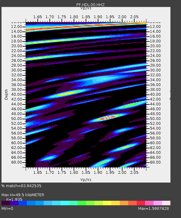
HDL Station Sismologique de Hubert Delisle - Earthquake Result Viewer
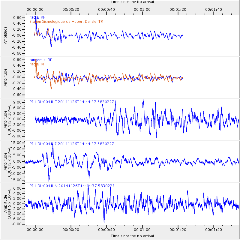
Earthquake location: Northern Molucca Sea
Earthquake latitude/longitude: 1.9/126.5
Earthquake time(UTC): 2014/11/26 (330) 14:33:43 GMT
Earthquake Depth: 39 km
Earthquake Magnitude: 6.8 MWW, 6.8 MWC, 6.8 MWB, 7.0 MI
Earthquake Catalog/Contributor: NEIC PDE/NEIC COMCAT
Network: PF Volcanologic Network of Piton de Fournaise-OVPF
Station: HDL Station Sismologique de Hubert Delisle
Lat/Lon: 21.25 S/55.79 E
Elevation: 242 m
Distance: 72.8 deg
Az: 247.188 deg
Baz: 80.973 deg
Ray Param: 0.053351697
Estimated Moho Depth: 49.5 km
Estimated Crust Vp/Vs: 1.93
Assumed Crust Vp: 4.73 km/s
Estimated Crust Vs: 2.444 km/s
Estimated Crust Poisson's Ratio: 0.32
Radial Match: 83.942535 %
Radial Bump: 400
Transverse Match: 78.20992 %
Transverse Bump: 400
SOD ConfigId: 3390531
Insert Time: 2019-04-15 04:59:29.477 +0000
GWidth: 2.5
Max Bumps: 400
Tol: 0.001

Signal To Noise

ChannelStoNSTALTA
PF:HDL:00:HHZ:20141126T14:44:37.583022Z4.3893022.1273383E-64.8466444E-7
PF:HDL:00:HHN:20141126T14:44:37.583022Z0.9795138.9275983E-79.114324E-7
PF:HDL:00:HHE:20141126T14:44:37.583022Z1.75599521.6769196E-69.549682E-7
Arrivals
Ps10.0 SECOND
PpPs30 SECOND
PsPs/PpSs40 SECOND