You are here: Home > Network List > TA - USArray Transportable Network (new EarthScope stations) Stations List
> Station G55A Calabogie, ON, CAN > Earthquake Result Viewer
G55A Calabogie, ON, CAN - Earthquake Result Viewer

| Earthquake location: |
Near Coast Of Peru |
| Earthquake latitude/longitude: |
-15.8/-74.5 |
| Earthquake time(UTC): |
2013/09/25 (268) 16:42:43 GMT |
| Earthquake Depth: |
40 km |
| Earthquake Magnitude: |
7.1 MWW, 6.8 MI, 7.0 MWB, 7.0 MWC, 7.1 MWW, 7.1 MWC |
| Earthquake Catalog/Contributor: |
NEIC PDE/NEIC COMCAT |
|
| Network: |
TA USArray Transportable Network (new EarthScope stations) |
| Station: |
G55A Calabogie, ON, CAN |
| Lat/Lon: |
45.25 N/76.72 W |
| Elevation: |
228 m |
|
| Distance: |
60.8 deg |
| Az: |
358.214 deg |
| Baz: |
177.567 deg |
| Ray Param: |
0.061193414 |
| Estimated Moho Depth: |
31.25 km |
| Estimated Crust Vp/Vs: |
1.98 |
| Assumed Crust Vp: |
6.577 km/s |
| Estimated Crust Vs: |
3.326 km/s |
| Estimated Crust Poisson's Ratio: |
0.33 |
|
| Radial Match: |
98.88526 % |
| Radial Bump: |
146 |
| Transverse Match: |
95.12344 % |
| Transverse Bump: |
397 |
| SOD ConfigId: |
626651 |
| Insert Time: |
2014-04-18 20:36:27.007 +0000 |
| GWidth: |
2.5 |
| Max Bumps: |
400 |
| Tol: |
0.001 |
|
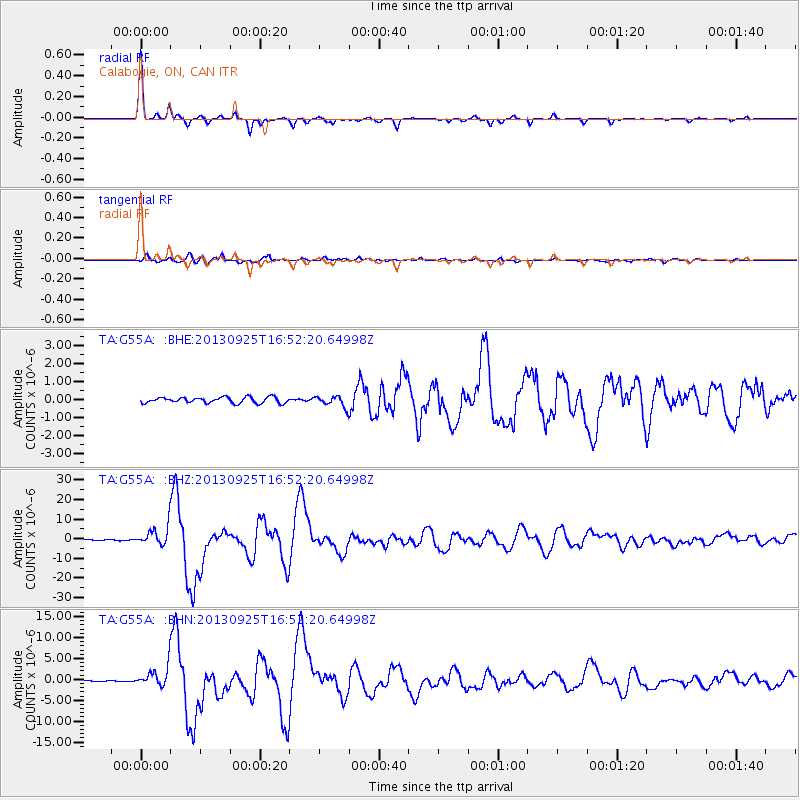
Signal To Noise
| Channel | StoN | STA | LTA |
| TA:G55A: :BHZ:20130925T16:52:20.64998Z | 20.826689 | 4.9101104E-6 | 2.357605E-7 |
| TA:G55A: :BHN:20130925T16:52:20.64998Z | 9.852993 | 2.403585E-6 | 2.4394467E-7 |
| TA:G55A: :BHE:20130925T16:52:20.64998Z | 1.8519685 | 2.9553286E-7 | 1.595777E-7 |
| Arrivals |
| Ps | 4.8 SECOND |
| PpPs | 14 SECOND |
| PsPs/PpSs | 18 SECOND |


