You are here: Home > Network List > CI - Caltech Regional Seismic Network Stations List
> Station TIN Tinemaha, California, USA > Earthquake Result Viewer
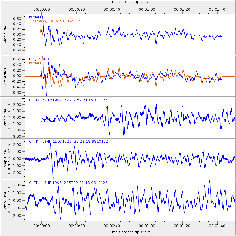
TIN Tinemaha, California, USA - Earthquake Result Viewer
*The percent match for this event was below the threshold and hence no stack was calculated.
| Earthquake location: |
Near Coast Of Chiapas, Mexico |
| Earthquake latitude/longitude: |
14.1/-92.3 |
| Earthquake time(UTC): |
1997/12/25 (359) 22:16:19 GMT |
| Earthquake Depth: |
10 km |
| Earthquake Magnitude: |
5.4 MB, 5.3 MS, 5.8 UNKNOWN, 5.5 MD |
| Earthquake Catalog/Contributor: |
WHDF/NEIC |
|
| Network: |
CI Caltech Regional Seismic Network |
| Station: |
TIN Tinemaha, California, USA |
| Lat/Lon: |
37.05 N/118.23 W |
| Elevation: |
1164 m |
|
| Distance: |
32.5 deg |
| Az: |
319.32 deg |
| Baz: |
127.779 deg |
| Ray Param: |
$rayparam |
*The percent match for this event was below the threshold and hence was not used in the summary stack. |
|
| Radial Match: |
71.49404 % |
| Radial Bump: |
400 |
| Transverse Match: |
71.919685 % |
| Transverse Bump: |
400 |
| SOD ConfigId: |
4480 |
| Insert Time: |
2010-02-25 20:52:24.063 +0000 |
| GWidth: |
2.5 |
| Max Bumps: |
400 |
| Tol: |
0.001 |
|
Signal To Noise
| Channel | StoN | STA | LTA |
| CI:TIN: :BHN:19971225T22:22:18.981012Z | 3.084385 | 4.8062213E-7 | 1.558243E-7 |
| CI:TIN: :BHE:19971225T22:22:18.981012Z | 0.6022025 | 3.0556984E-7 | 5.0742045E-7 |
| CI:TIN: :BHZ:19971225T22:22:18.981012Z | 0.82237697 | 2.8212116E-7 | 3.4305577E-7 |
| Arrivals |
| Ps | |
| PpPs | |
| PsPs/PpSs | |


