You are here: Home > Network List > AV - Alaska Volcano Observatory Stations List
> Station MAPS Pakushin Southeast, Makushin Volcano, Alaska > Earthquake Result Viewer
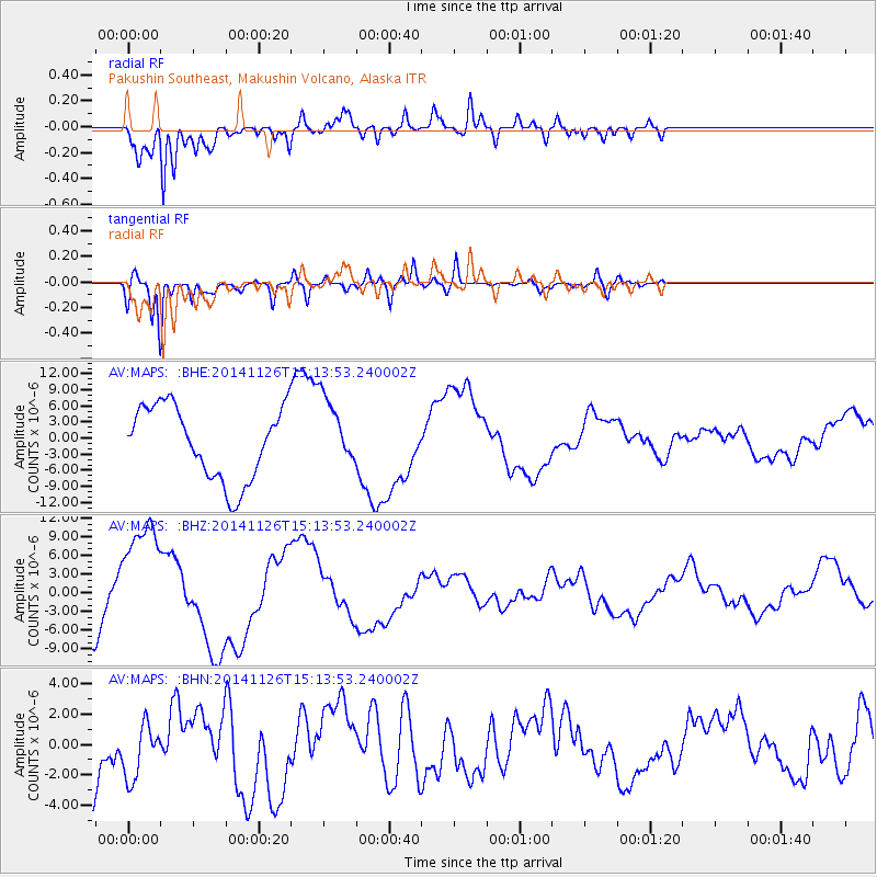
MAPS Pakushin Southeast, Makushin Volcano, Alaska - Earthquake Result Viewer
*The percent match for this event was below the threshold and hence no stack was calculated.
| Earthquake location: |
Northern Molucca Sea |
| Earthquake latitude/longitude: |
1.9/126.5 |
| Earthquake time(UTC): |
2014/11/26 (330) 15:02:48 GMT |
| Earthquake Depth: |
47 km |
| Earthquake Magnitude: |
5.0 mb, 5.0 mb |
| Earthquake Catalog/Contributor: |
ISC/ISC |
|
| Network: |
AV Alaska Volcano Observatory |
| Station: |
MAPS Pakushin Southeast, Makushin Volcano, Alaska |
| Lat/Lon: |
53.81 N/166.94 W |
| Elevation: |
333 m |
|
| Distance: |
74.8 deg |
| Az: |
34.32 deg |
| Baz: |
251.834 deg |
| Ray Param: |
$rayparam |
*The percent match for this event was below the threshold and hence was not used in the summary stack. |
|
| Radial Match: |
94.54982 % |
| Radial Bump: |
400 |
| Transverse Match: |
87.930275 % |
| Transverse Bump: |
400 |
| SOD ConfigId: |
3390531 |
| Insert Time: |
2019-04-15 05:08:07.660 +0000 |
| GWidth: |
2.5 |
| Max Bumps: |
400 |
| Tol: |
0.001 |
|
Signal To Noise
| Channel | StoN | STA | LTA |
| AV:MAPS: :BHZ:20141126T15:13:53.240002Z | 1.5633885 | 9.907345E-6 | 6.3370976E-6 |
| AV:MAPS: :BHN:20141126T15:13:53.240002Z | 0.9846511 | 1.7915905E-6 | 1.819518E-6 |
| AV:MAPS: :BHE:20141126T15:13:53.240002Z | 0.96301275 | 6.5489025E-6 | 6.800432E-6 |
| Arrivals |
| Ps | |
| PpPs | |
| PsPs/PpSs | |


