TLY Talaya, Russia - Earthquake Result Viewer
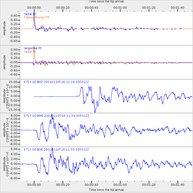
Earthquake location: Kodiak Island Region, Alaska
Earthquake latitude/longitude: 57.1/-153.2
Earthquake time(UTC): 2001/01/10 (010) 16:02:44 GMT
Earthquake Depth: 33 km
Earthquake Magnitude: 6.2 MB, 6.8 MS, 7.1 MW, 6.8 ML
Earthquake Catalog/Contributor: WHDF/NEIC
Network: II Global Seismograph Network (GSN - IRIS/IDA)
Station: TLY Talaya, Russia
Lat/Lon: 51.68 N/103.64 E
Elevation: 579 m
Distance: 54.7 deg
Az: 312.002 deg
Baz: 40.676 deg
Ray Param: 0.06524097
Estimated Moho Depth: 41.25 km
Estimated Crust Vp/Vs: 1.92
Assumed Crust Vp: 6.419 km/s
Estimated Crust Vs: 3.335 km/s
Estimated Crust Poisson's Ratio: 0.32
Radial Match: 99.00925 %
Radial Bump: 282
Transverse Match: 90.707275 %
Transverse Bump: 400
SOD ConfigId: 3744
Insert Time: 2010-03-01 16:59:31.273 +0000
GWidth: 2.5
Max Bumps: 400
Tol: 0.001

Signal To Noise

ChannelStoNSTALTA
II:TLY:00:BHN:20010110T16:11:39.305012Z47.1781272.7295316E-65.785587E-8
II:TLY:00:BHE:20010110T16:11:39.305012Z31.2399941.8419171E-65.8960225E-8
II:TLY:00:BHZ:20010110T16:11:39.305012Z69.667725.346182E-67.6738296E-8
Arrivals
Ps6.2 SECOND
PpPs18 SECOND
PsPs/PpSs24 SECOND